- Province: Western Cape
- District: Cape Winelands
- Coordinates:33°10.86′S 19°0.6′E
- Area:2.13 km2
- Municipality: Drakenstein
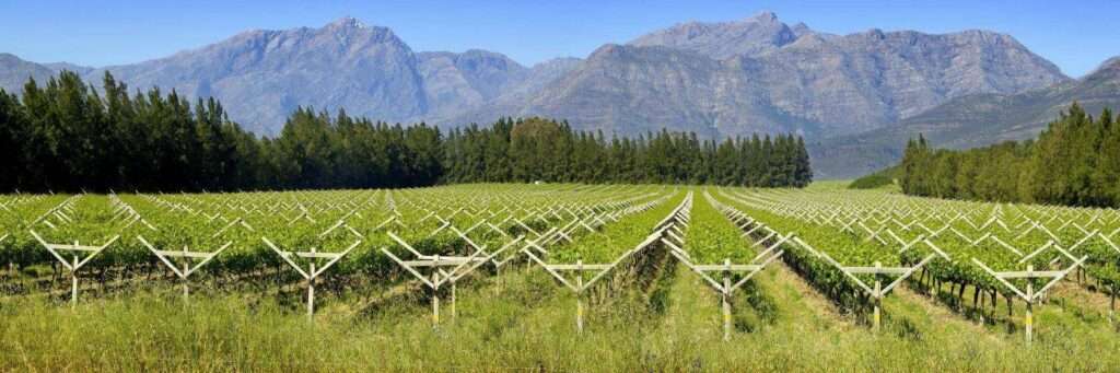
Saron is a small settlement in the Berg River Valley in the Western Cape, about 12 km north of Tulbagh and 45 km from Worcester. It lies on the R44 route between Tulbagh and Gouda, surrounded by wheat farms and vineyards at the foot of the Obiqua Mountains. The village developed around a mission station and today serves the surrounding agricultural area.
Older maps sometimes refer to the mountains around Tulbagh as the Obiqua (or Obiekwa) Mountains. The name is believed to come from a Khoekhoe word recorded in early colonial surveys. Today, the term is rarely used locally, and most people simply refer to the Tulbagh or Winterhoek mountains.
History of Saron
Mission station for freed slaves and Indigenous people
The town was established when Johannes Heinrich Kulpmann of the Rhenish Mission Society settled there in 1848. He bought the farm Leeuwenklip. The mission was established to serve the freed slaves and the indigenous people in the area. The name is of biblical origin and means”flats or plain” The mission provided education and skills development for the inhabitants. Some of these skills learned all those years ago have been passed down through generations and are still used in the area today. The mission was later (after 1945) run by the Dutch Reformed church, and it is still standing; the mission is a heritage site.
The town’s name is written on the side of the Saronsberg mountain, which can be seen from the air. Saron was proclaimed a town in 1929, and the church had to surrender control to secular authority.
The postcode for the area is 6812
-
Resources
Practical information for the Western Cape, Regulations, permits and helpful tips. See theColourdots coastal and nature use guide
local WEATHER TODAY
Browse businesses and places to visit in Saron

Useful Numbers
Residents and visitors can find important local contact numbers below, including police, medical services, utilities, and community facilities in and around
-
Emergency Services
- Fire: 021-807 400
- Ambulance: 10177
- Police: 023 240 8000
-
Medical
- Closest hospital;Lapamunnik Hospital-ER-022 931 2140
- Clinic: 023 240 0078
-
Municipal & Utilities
- Municipality-021 807 4500 (Drakenstein
- Electricity:021 807467
-
Transport & Roads
- Traffic department: 021 807 628
-
Community & Safety
- SPCA: – Wellington-021 864 3726
-
Local Contacts and Community Resources in Saron
- Post office; Agency – 23 640 0012
- Library:023 240 001
- Community hall, Cnr Main and Burg streets 073 444 5564
-
Schools in Saron
- Saron Primary School 023 240 0016
-
-
- Colourdots is an independent regional information resource for the Western Cape.
Learn more about the project HERE
- Colourdots is an independent regional information resource for the Western Cape.
-