- Province: Western Cape
- Winelands
- Coordinates: 33°17′6″S 19°8′16″E
- Area:3.81 km2
- Municipality: Witzenberg
History of Tulbagh
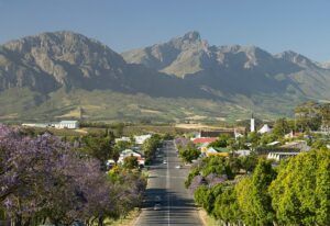
Tulbagh is the commercial and administrative centre for the Witzenberg district. The basin has been inhabited for thousands of years by indigenous Bushmen and Khoi peoples.
Dutch and Huguenot settlers
In 1699 Dutch and Huguenot settlers were granted land in this area by the Dutch colonial government. The area was known as “Land van Waveren’ after the Oetgens van Waveren family, who were connected to Simon Van Der Stel on his mother’s side. The region was also known as Roodezand but the name of the area was later changed to Tulbagh after Ryk Tulbagh who was a governor at the Cape from 1751 to 1771. The town gained municipal status in 1861.
Local architecture
As the town developed, the buildings reflected the periods of Cape Dutch, Victorian and Edwardian architecture. Fine examples of these can be seen there today. Church Street boasts 32 national monuments which were carefully rebuilt after the devastating earthquake of 1969. The Dutch Reformed Church was built in 1743 for the congregation here, which called itself Roodezand. (Red sand)

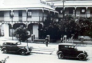
Vintage picture of the hotel
Economy
The economy of the town revolves around agriculture, predominantly fruit and wine. The oldest wine co-op in South Africa is here. Some wheat is also grown. Sheep farming also contributes to the economy. Domestic water is supplied from a spring in the mountainside.

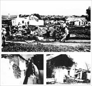
Earthquake 1969
Tulbagh lies directly over a fault in the subterranean rock system in the valley. Tremors have been a regular occurrence. However, none so severe as the quake on 29 September 1969. Many of the historic buildings were severely damaged by. Soft brick walls and gables crumbled and collapsed. Extensive repair operations were undertaken and the town now has one of the largest numbers of local heritage sites in South Africa.
The license plate prefix for Tulbagh is CCM and the postal code is 6820
local WEATHER TODAY
all listings in Tulbagh
Things to do and see in Tulbagh
- Christmas in winter
- Duikersdrift parkrun . Join us for a free, timed 5km run/walk at 8 am every Saturday! duikersdriftoffice@parkrun.com
- Take a guided tour with Voice Map
- Annual wildflower show at the local Show Grounds held in September. Started in 1887.
- Explore Tulbagh

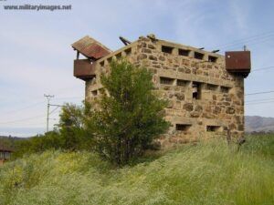
- Boer War Blockhouse
- Annual arts festival, a weekend of Art, Music, Food and Wine 079 446 3791
Useful Numbers
- Police: 023 230 8100
- Municipality – 023 316 1854
- Traffic department: Ceres Traffic Department – 023 316 1997
- Fire: 023 316 1997/8
- Water:023 3168547
- Electricity:023 3168540
- Ambulance:023 230 1326
- Post office; 023 230 0001
- Library: WITZENVILLE PUBLIC LIBRARY – 023 316 1854
- Closest hospital; Trident Health Centre-076 049 0511
- Clinic – 023 230 8020
- Pharmacy; Sunbird MediPharmacy At Spar -023 880 0035
- SPCA: Wellington – 021 864 3726
- Schools:
- Hoërskool Tulbagh – 023 230 1091
- Lingomso Primary School – 023 230 0012
- Waveren High School – 0232301002
- Rijk Tulbagh Private School – 0232302807
- Museum;
- Earthquake Museum And Tourism Bureau – 023 230 1348
- Oude Kerk Volksmuseum – 023 230 1041
- Tourism– (0)23 230 1348
See also Gouda


