
- Province: Western Cape
- Coordinates: 33.9068° S, 18.5808° E
- Area: 27.08 km2
- Municipality; City of Cape Town
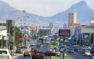
Parow is a northern suburb of Cape Town in the Tygerberg area, about 20 km from the city centre. It lies between Goodwood, Bellville and Plattekloof, close to the N1 highway and Voortrekker Road. The suburb developed around the railway line and Parow Station and today forms part of the larger Bellville commercial and residential region, with easy access to the Cape Town International Airport and Tygerberg Hospital.
History of Parow
In 1865, a huge storm off Table Bay caused 19 ships to be stranded. One of them, the Kehrweider, was captained by Johann Heinrich Ferdinand Parow. He decided to remain in the Cape and later married Johanna Wilhelmina Timmerman, whose family had helped him after the shipwreck.
Parow saw an opportunity in the Tyger Valley region and began promoting and selling the area for cattle trading. He eventually acquired considerable wealth and laid out the village, giving several streets names connected to his family, including Timmerman Straat, named after his wife.
In the early 1900s, Voortrekker Road(Main Road) was still a dusty, unpaved track rather than the major commercial highway it is today. Local businessman Morris Mazzur operated a large dairy farm on land that is now part of the modern suburb of Tiervlei/Tygerberg.
Parow had a local management board from 1902 but only became a municipality in 1939. The town was included in the Cape Town municipal land area in 1944 and was incorporated into the newly formed City of Tygerberg in 1996.
Many of the town’s street names were changed at the time of the centenary of the Great Trek. Some of the names associated with Captain Parow and his family were removed. Timmerman Straat disappeared from the map, while names reflecting the Great Trek were introduced, including Sarel Cilliers Street and Piet Retief Street. Main Road was also renamed Voortrekker Road.
By the mid-20th century, Parow had a close-knit Eastern European Jewish community that played an important role in developing the suburb’s early commercial centre along Station Road. One of the businesses was the steel company Cape Gate, which grew from a modest wire and fencing shop.
The community experienced considerable upward mobility, and many families later moved further north or to the Atlantic Seaboard. The Jewish community in Parow is now much smaller, and the historic Parow synagogue has been deconsecrated and sold.
The postal codes are Street Code 7500 and Box Code 7499
Transport
Parow is served by Metrorail, Golden Arrow Bus Services, and minibus taxis. See linked pages for details. Other options for getting around the Western Cape.
Things to see and do in Parow
- Trim Park Outdoor Gym De Grendel Road
- Captain Parow’s sea telescope is on display at the Parow town hall.
- Captain Parow’s sea telescope is on display at the Parow town hall.
- Khoisan Whale and Marine Museum 5 Hopkins St, 083 416 3062(Closed)
- Hugo Lambrechts Auditorium 021 939 9105
Resources
Practical information for the Western Cape, Regulations, permits and helpful tips. See the Colourdots coastal and nature use guide
local WEATHER TODAY
Browse businesses and places to visit in Parow

Useful Numbers in Parow
Residents and visitors can find important local contact numbers below, including police, medical services, utilities, and community facilities in and around
-
Emergency Services
- Police: 021 929 7037
- Fire: Goodwood;021 590 1900
- Ambulance: 10177
-
Medical
- Closest hospital: Day Hospital 078 671 1226
- Community health care centre; 021 444 0924
- Pharmacy; Faulls 021 939 2120
-
Municipal & Utilities
- Water: 0860 103 089
- Electricity:0860 103 089
-
Transport & Roads
- Traffic department: Goodwood 021 444 7151
-
Community & Safety
- SPCA: 021 700 4140
- Childline South Africa: 116
- 24 hour Poisons Information Helpline of the Western Cape: 0861 555 777.
-
Local Contacts and Community Resources in Parow
- Post office; 021 939 8080
- MC Fick Hall:021 444 0916
- Community Centre: 021 444 0265
- Avondale community centre 021 571 7080
- Ravensmead Multipurpose Centre: 021 444 0916
- Civic Hall: 021 444 0916
- Library: 021 444 0940
- Museum: 021 911 5907
-
Schools in Parow
Florida High School 021 931 8922
P North primary:021 930 2663
Parow Primary; 021 911 3357
P East primary; 021 930 8655
P West primary; 073 548 965
Hoerskool Parow 021 939 4145
P prep;021 939 4582
P vallei prep 021 931 6251
- Find a comprehensive list of Cape Town emergency numbers
FAQs about Parow
1. Where is it located?
Parow is in Cape Town’s northern suburbs, about 15 km from the city centre, between Goodwood and Bellville, along Voortrekker Road.
2. What is it known for?
The suburb is known for Parow Centre, Tygerberg Rugby Stadium, and is one of Cape Town’s oldest established suburbs, with easy access to major roads.
3. What type of area is it?
It’s a mixed residential and commercial suburb, offering affordable housing, shopping areas, and light industry zones.
4. How do you get there?
It is easily reached via the N1, Voortrekker Road, or De La Rey Road, with train and bus services linking it to the city.
5. What shopping centres are nearby?
The main retail hub is Parow Centre, with additional options like China Town and nearby N1 City Mall.
6. Is it a safe area?
It’s a busy urban area with active community policing and neighbourhood watch groups in residential zones.
7. What attractions or facilities are there?
Notable sites include Tygerberg Rugby Stadium, Parow Golf Course, and Jack Muller Park, popular for jogging and outdoor events.
8. Is there public transport?
Yes Metrorail trains, Golden Arrow buses, and taxis operate through Parow daily, making it well-connected.
9. Is it family-friendly?
Yes, it offers schools, parks, and sports clubs, making it suitable for families seeking affordable, central living.
- Colourdots is an independent regional information resource for the Western Cape.
Learn more about the project HERE
Updated October 2025