
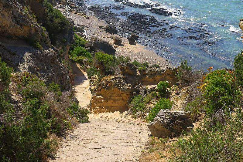
- Province: Western Cape
- District; Garden Route
- Coordinates:34°18′S 21°2′E
- Municipality: Hessequa
Vermaaklikheid lies in the Hessequa region of the Western Cape, on the southern bank of the Duiwenhoks River. The settlement is reached via gravel roads and is surrounded by low-lying farmland, tidal wetlands, and agricultural smallholdings. Its position near the river estuary shapes both land use and environmental management in the area.
History of Vermaaklikheid
Meaning of the Name
The name Vermaaklikheid means “amusement” or “entertainment” in Afrikaans. One explanation links the name to the small-scale local production of sweet potatoes and witblits, while another, disputed, version attributes it to Meneer Vermaak, a prominent 19th-century farmer in the area.
In the early 1900s, Vermaaklikheid was a busy social and agricultural centre, with acres of hanepoot vineyards. The exceptionally sweet grapes were used to distil witblits, literally “white lightning”, a potent South African moonshine. As distilling without a permit was illegal, local legend tells of a remarkably efficient warning system: when word travelled along the long gravel road that a government inspector was approaching, copper stills and bottles of witblits were swiftly hidden away in secret compartments beneath the floors of the thatched cottages.
Another local legend gives the name a rather more convivial origin. Frontier farmers travelling through the dry Karoo and coastal fynbos would apparently welcome the sight of the cool, freshwater Duiwenhoks River. On reaching its banks, they could unhitch their wagons, open their wine and settle down to vermaak – relaxing, hunting and socialising. According to the story, the relief and enjoyment of reaching the river gave the valley its association with a good time, and eventually its name, Vermaaklikheid.
Economy and Development
The surrounding area consists mainly of small farms and agricultural plots. Lime-rich soils once supported the Hannepoort vineyards. A large original farm of approximately 15 000 hectares was later subdivided, resulting in the smallholdings seen today.
Vermaaklikheid historically served as a halfway stop between Stilbaai and Riversdale. A toll house once stood here to collect road taxes from passing travellers. Today, the area includes fruit and olive plantations and a small number of Cape-style cottages along gravel roads.
Architecture and Settlement
Most of the historic thatched houses are kapstylhuise (cape-style cottages). These stand on a portion of the former farm Kleinfontein, which once operated as a holiday campsite for local farmers.
Residents from Vermaaklikheid and nearby Brakfontein were allowed to build houses here for a nominal annual rental. Almost all were constructed in the traditional kapstylhuis form, a building style with roots in Europe dating back to around 500 AD and later adopted by pioneering farmers during inland treks in the 18th century.
Planning and Environmental Controls
Vermaaklikheid has strict architectural guidelines to preserve its rural character. Environmental regulations apply to the tidal areas of the Duiwenhoks River, and legislation governs the use of local jetties and slipways.
.
The license plate prefix for Vermaaklikheid is CCC, and the post code is 6671
WEATHER IN VERMAAKLIKHEID TODAY
Browse businesses and things to see in Vermaaklikheid
Resources
Practical information for the Western Cape, Regulations, permits and helpful tips. See the Colourdots coastal and nature use guide
Things to see and do in Vermaaklikheid
- Blombos Nature Reserve,
- Blombos Cave is on a cliff above the Ocean, east of De Hoop Nature Reserve.
- De Hoop Nature Reserve
- The Duiwenhoks is rich in kob, leervis, spotted grunter and white steenbras; a licence is required; spearfishing is not allowed. There are limits for bags and bait, and throwing nets is not allowed between sunset and sunrise.
- Nearby Witsand is the southern right whale nursery of the Cape.

Useful Numbers
Residents and visitors can find important local contact numbers below, including police, medical services, utilities, and community facilities
-
Emergency Services
- Police: Riversdale -10111 or 028 713 8500
- Fire: 083 9411 653; House & Structural Fires-084 014 1828
- Ambulance: 10177/028 713 4554
-
Medical
- Closest hospital: Riversdale 028 713 2445
- Clinic; Slangrivier Clinic 028 722 2522
- Pharmacy; Riversdale Pharmacy-028 713 1089
-
Municipal & Utilities
- Municipality; Hessequa Main Switchboard:028 713 8000 ward 3
- Emergency Number:084 014 1828
- Water: 028 713 8000
- Electricity: 028 713 8000
-
Transport & Roads
- Traffic department: Riversdale Traffic Department-028 713 8000
- Road Emergencies / SANRAL: 0800 204 204
-
Community & Safety
- NSRI 087 094 9774
- 24 hour Poisons Information Helpline of the Western Cape: 0861 555 777
- SPCA: Garden Route 044 693 0824 Riversdal Dierekliniek- 028 713 1123
-
Local Contacts and Community Resources
- Post office; Riversdale Post Office-028 713 1168 Stilbaai 028 754 1115
- Library: 072 760 6232
- Tourism; Hessequa Tourism:028 713 7829
-
Schools in Vermaaklikheid
- VGK Primary School 087 357 7880
Towns in the Hessequa district include: Albertinia; Gouritsmond; Groot Jongensfontein; Heidelberg; Port Beaufort; Riversdale; Riviersonderend; Slang River; Stilbaaiand Witsand
- Colourdots is an independent regional information resource for the Western Cape.
Learn more about the project HERE