
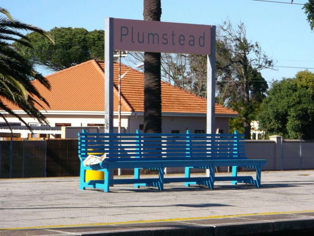
- Province: Western Cape
- Coordinates: 34°1′20″S 18°28′20″E.
- Municipality: City of Cape Town
- Area: 4.58 km2
Plumstead is a suburb in the Southern Suburbs of Cape Town, situated east of Claremont and north of Constantia. It lies west of Diep River and south of Rondebosch. The suburb provides convenient access to shopping centres, schools, parks, and public transport routes connecting to central Cape Town and nearby Southern Suburbs
History of Plumstead
In 1762, a large tract of land beyond Wynberg and the Constantia Valley was granted to Hendrick Jergens and Johan Barrens, two free-burgher Dutch settlers. They named their properties Rust (Rest) and Werk (Work), and old maps show a landscape of farms and estates including Oude Wijnbergh, Vredenhof and Rust en Werk. After the decline of the Dutch East India Company and the British occupation of the Cape, the land was granted to Hendrick Bouman Brigeraad.
An Englishman, Henry Batt, arrived at the Cape in 1807 and eventually acquired part of the old Rust en Werk property. He called his farm Plumstead, after Plumstead in England. He farmed there until he died in 1833, when the property was subdivided. The wooded part of his land became known as Batt’s Wood, a name that survived long after the farm itself disappeared. Batt was buried on his own property.
An old Cape building on Castletown Road is believed to be a surviving farmstead or farm building associated with Batt’s property. The simple building has a stoep and plastered seating. Its original thatched roof was replaced with corrugated iron.
Other large estates once occupied the surrounding countryside. Timour Hall, for example, had extensive grazing land, gardens, stabling and vineyards. A nineteenth-century description records around 35,000 vines on the estate.
The history of Plumstead was not only the story of wealthy landowners and large farms. After slavery was abolished at the Cape in the 1830s, former slaves and people described in nineteenth-century records as “free blacks” acquired small plots in the area around Plumstead and Wynberg. They mostly worked as artisans, craftsmen, gardeners, labourers, traders and domestic workers. Later generations included railway workers, teachers and shopkeepers. Muslim and Christian families, farmers, craftsmen and labourers all formed part of the community that developed around the old farms.
The railway brought another major change. The line reached Wynberg in 1864, opening the area to easier movement and helping to change the character of the southern suburbs. In 1882, the railway was extended from Wynberg towards Muizenberg, with Plumstead becoming one of the stopping places on the new route. The station also handled agricultural produce, particularly fruit from the Constantia Valley, and the old goods sheds near the station remain as reminders of the area’s farming past. Find out more about the railways in the Western Cape
Plumstead changed considerably as the surrounding farms and estates were subdivided and new houses appeared. The suburb expanded rapidly after the Second World War, eventually replacing much of the old rural landscape with the residential neighbourhood seen today. Yet traces of the earlier Plumstead remain in its old buildings, railway infrastructure, surviving names and the stories of the people who lived and worked here.
The postcode for Plumstead is 7800 (Streets) 7801 (Boxes)
Transport
Plumstead is served by Metrorail Golden Arrow Bus Services, and minibus taxis. See linked pages for details. Other options for getting around the Western Cape.
Things to see and do in Plumstead
- Dan Pienaar Circle Park Outdoor Gym
- Wicklow Road Park Outdoor Gym, Wicklow Road
- Kingfisher Road Park Outdoor Gym, Kingfisher Road, Southfield
- 3 Arts Village shopping centre
- Timor Hall
- Thrift shopping
- Collectible books
Resources
Practical information for the Western Cape: regulations, permits and helpful tips. See the Colourdots coastal and nature use guide

Useful Numbers
Residents and visitors can find important local contact numbers below, including police, medical services, utilities, and community facilities
-
Emergency Services
- Police: Diep River – 021 710 7300
- Fire: Wynberg 021 444 9623
- Ambulance: 10177
- COCT: emergency 107 ( City of Cape Town)
-
Medical
- Lady Michaelis Clinic 021 797 8171
- Constantiaberg Mediclinic 086 122 5222
-
Municipal & Utilities
- Water: Municipal offices 021 710 9430 / 0860 103 089
- Electricity: 021 710 9430 / 0860 103 089
-
Transport & Roads
- Traffic department: Motor vehicle registration 3 Victoria Road, 0860103089
- Road Emergencies / SANRAL: 0800 204 204
-
Community & Safety
- Childline-116
- 24-hour Poisons Information Helpline of the Western Cape: 0861 555 777.
- NSRI 087 094 9774
- SPCA: Cape Of Good Hope Grassy Park 021 700 4140
-
Local Contacts and Community Resources
- Post office: 021 762 3185
- Library: 021 797 7240
-
Schools in Plumstead
- John Graham Primary School 021 797 4243
- Timour Hall Primary School 021 762 1161
- Preparatory School 021 705 3700
- High School 021 761 8006
- Find a comprehensive list of Cape Town Emergency numbers HERE
- The City of Cape Town Public Emergency Communication Centre is available 24/7. For all life or property-threatening emergencies, call 021 480 7700 from any phone or 107 from a landline or report online at https://bit.ly/3o4Ji3K
- Colourdots is an independent regional information resource for the Western Cape.
Learn more about the project HERE