
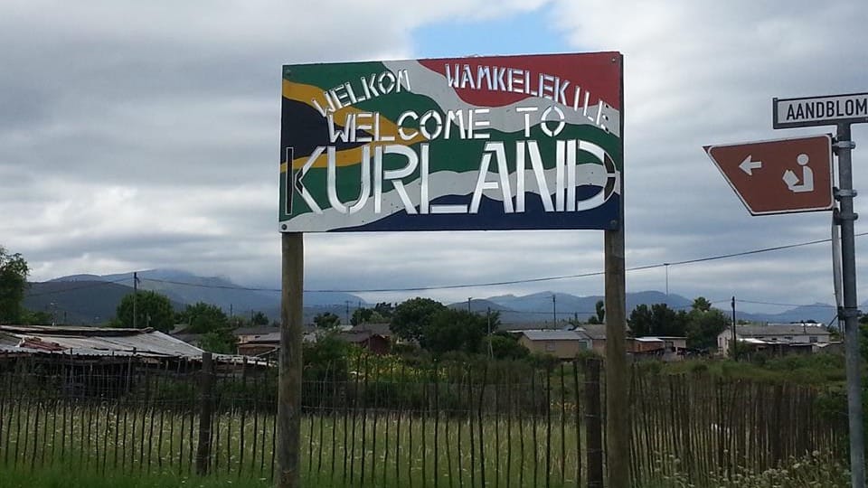
- Province: Western Cape
- District: Garden Route
- Coordinates:33°56′45″S 23°29′39″E
- Area:1.24 km2
- Municipality – Bitou
Jump to: History of Kurland Village | Useful Numbers in Kurland Village
Kurland Village is a small settlement located inland from Plettenberg Bay along the Garden Route in the Western Cape. It lies near the foothills of the Tsitsikamma Mountains and forms part of the Bitou Local Municipality. The area is situated north of the N2 national route that connects Plettenberg Bay with Knysna to the west, placing it within the scenic Garden Route region of South Africa.
History of Kurland Village
Kurland Village today is a rural township located in the Crags area at the edge of the Tsitsikamma Nature Reserve. It is home to mostly “Coloured” and Xhosa families. Some families have been there for over 50 years, while others are more recent arrivals. A large number of residents are employed in the tourism industry. The majority of homes are built from brick, concrete block or wood. Small corner container stores with assortments of produce and goods are scattered throughout.
The name of Kurland traces back to an interesting story. In 1941, Baron Peter Behra, a Russian nobleman who had been chased out of his ancestral lands on the Baltic Sea by the Bolsheviks, bought up several rural farms in the valley. He named the territory “Kurland” in honour of the historic Courland (Kurland) Governorate of the Russian Empire in modern-day Latvia
The original 1880s homestead on the estate was hand-moulded from a traditional formula using earth and clay clods. To survive, the exiled Baron experimented with unconventional farming methods, covering the parched earth with plantations of Tung nut trees (used to produce industrial oil) and then youngberries before building a brickworks enterprise.
Before the N2 highway or the Bloukrans Bridge was built, the original farmhouse in the mid-1900s also functioned as an inn. Early travellers making the two-week horse and ox-wagon journey from Cape Town to Port Elizabeth faced a difficult traverse. Kurland was the final oasis where travellers stopped to rest before the near-impossible trek
The license plate prefix for Kurland Village is CX and the postal code is 6602
Resources
Practical information for the Western Cape, regulations, permits and helpful tips. See the Colourdots coastal and nature use guide
local WEATHER TODAY
Browse businesses and places to visit inKurland Village

Useful Numbers in Kurland Village
Residents and visitors can find important local contact numbers below, including police, medical services, utilities, and community facilities
-
Emergency Services
- Police: 10111 or 044 501 1900/ 1907/1908
- Fire: 044 501 3240 / 3251
- Ambulance: 1017
-
Medical
- Pharmacy;Closest hospital; Mediclinic Plettenberg Bay-044 501 5100
- Clinic– 044 534 8737
-
Municipal & Utilities
- Municipality 044 501 3174/5
- Water: 044 501 3174/5
- Electricity:044 501 3174/5
-
Transport & Roads
- Traffic department:044 501 3240 / 3251
- Road Emergencies / SANRAL: 0800 204 204
- Childline-116
-
Community & Safety
- 24 hour Poisons Information Helpline of the Western Cape: 0861 555 777.
- NSRI 087 094 9774
- SPCA: PAWS -Animal Welfare Service -083 287 9917
-
Local Contacts and Community Resources
- Post office; Agency- 044 534 8710
- Library: 044 534 8341.
-
Schools in Kurland Village
- The Crags Primary School- 044 534 8840
Other towns and suburbs in the Bitou district include: Harkerville, Keurbooms River, Keurboomstrand, Kranshoek, Kurland village; Natures Valley; and Plettenberg Bay
- Colourdots is an independent regional information resource for the Western Cape.
Learn more about the project HERE