“History of Cape Town’s water system”
Cape Town is a city shaped by water. Long before roads, buildings, or formal streets, it was the steady flow of fresh mountain water that made settlement possible.
Streams flowing down Table Mountain fed the earliest community. These waters, known to the Khoisan as Camissa – “the place of sweet waters” – sustained people, livestock, and passing ships for centuries. Water was not just a resource. It was the reason the city exists.
The river was later named Varsche Rivier by Dutch settlers when they arrived in 1652.
The first canals
When Jan van Riebeeck established a refreshment station at the Cape in 1652, securing fresh water was a priority.
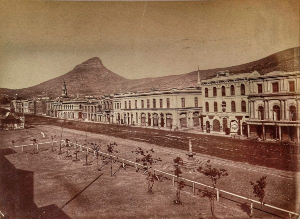
The settlers built a network of open canals, known as grachte, to channel water from streams such as Platteklip and Disa into the settlement. The main canal, the Heerengracht, ran along what is now Adderley Street. Others, including Buitengracht and Keizersgracht, carried water through different parts of the town.
Near the jetty, a small dam was built to help fill water casks for ships. A decade later, a cistern was added, and the canal system expanded across the growing settlement.
These canals supplied homes, irrigated gardens, and provided water for ships. Smaller channels, known as leiwater, branched into neighbourhoods. In some cases, water flowed through pipes made from hollowed-out tree trunks.
At the time, Cape Town resembled a small canal city. Walkways lined the water, and simple bridges crossed the streams. It was sometimes described as a “Little Amsterdam” at the southern tip of Africa.
Governor Willem Adriaan van der Stel later introduced pipes from the mountain to public fountains, while wells in places like Greenmarket Square supplemented the supply. Water was collected daily at public points, often by enslaved people. See the Hurling pump.
As the settlement expanded, so did the water demand. Early reservoirs were built, including one constructed in 1663 byZacharias Wagenaer. Remains of this structure still lie beneath the modern city, below the Golden Acre.
However, the canals, once clean and vital, became polluted. Waste was dumped into them. Water slowed, stagnated, and became unsafe. Windblown dirt and increasing use turned fresh water into a health hazard.
By the 1800s, the system could no longer cope with the growing population. Water-borne disease became a serious issue, yet improvements were slow and underfunded.
Hand pumps were introduced across the city. These “Hurling pumps”, powered by a swinging mechanism, allowed people to draw water from underground sources.
Under British administration, additional infrastructure was built. A reservoir in Hof Street supplied water via pipes running through the town. But natural sources like the Platteklip stream began to fail, and new storage systems became essential.
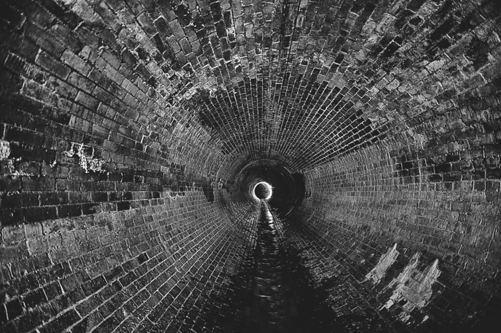
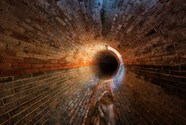
The canals underground
By the mid-19th century, the open canal system was no longer sustainable. Between the 1860s and 1880s, the canals were gradually enclosed and converted into underground tunnels and drains. Streets were built over them. The names remained, but the water disappeared from view.
Today, Heerengracht is Adderley Street, and Keizersgracht is Darling Street. Beneath the city, water still flows — unseen but constant.
Hidden rivers and secret tunnels
Much of this original system still exists. Beneath the network of tunnels is still there, carrying fresh water from the mountain to the sea. These are not dry relics. They are active channels, moving millions of litres of water every day.
In 1982, a section of a 17th-century canal was uncovered beneath Adderley Street. It confirmed that the system had not disappeared — it had simply been built over.
These underground waterways connect to later infrastructure, including reservoirs and mountain systems such as the Woodhead Dam, built in the late 1800s to secure supply.
Dams and reservoirs
A severe drought in the late 1870s exposed the city’s vulnerability. Water was rationed to households every second day, for only a few hours at a time.
The Molteno reservoir, completed in 1881, was intended to solve the problem. But initial rainfall was low, and the reservoir remained largely empty. When heavier rains finally came, structural failure caused it to burst, so the crisis continued.
Over time, Cape Town shifted from canals to large-scale infrastructure. Reservoirs were built across the city bowl, and dams were constructed on Table Mountain. The Woodhead Tunnel diverted water from the Disa Stream into storage.
This marked a clear shift from open water to controlled systems, from visible flow to hidden infrastructure. Water had to be engineered, measured, and managed.
The illusion of abundance
Cape Town has always had water, but never in unlimited supply. Springs such as Stadsfontein still produce millions of litres daily. Underground rivers continue to flow. Yet the city has faced repeated shortages throughout its history. The lesson is simple: Water may seem abundant, but it is never guaranteed.
Today, most people move through the city without realising what lies below. Beneath streets and buildings is a working system that dates back to 1652. These canals, tunnels, and reservoirs shaped the city’s layout, supported its growth, and continue to function quietly in the background. They are not just historical features. They are part of a living system. Cape Town’s lost canals are not truly lost.
Water as a shared responsibility
While access to water is a basic human right. Cape Town’s history shows that water must be respected.
See more Colourdots historical articles