- Province: Western Cape
- Overberg
- Coordinates: 34°49’58 S 20°00’12E.
- Municipality, Cape Aghullas
- Cape Agulhas: Southernmost Point of Africa
Jump to:History of L’Agulhas |Things to See and Do in L’Agulhas |Useful Numbers in L’Agulhas
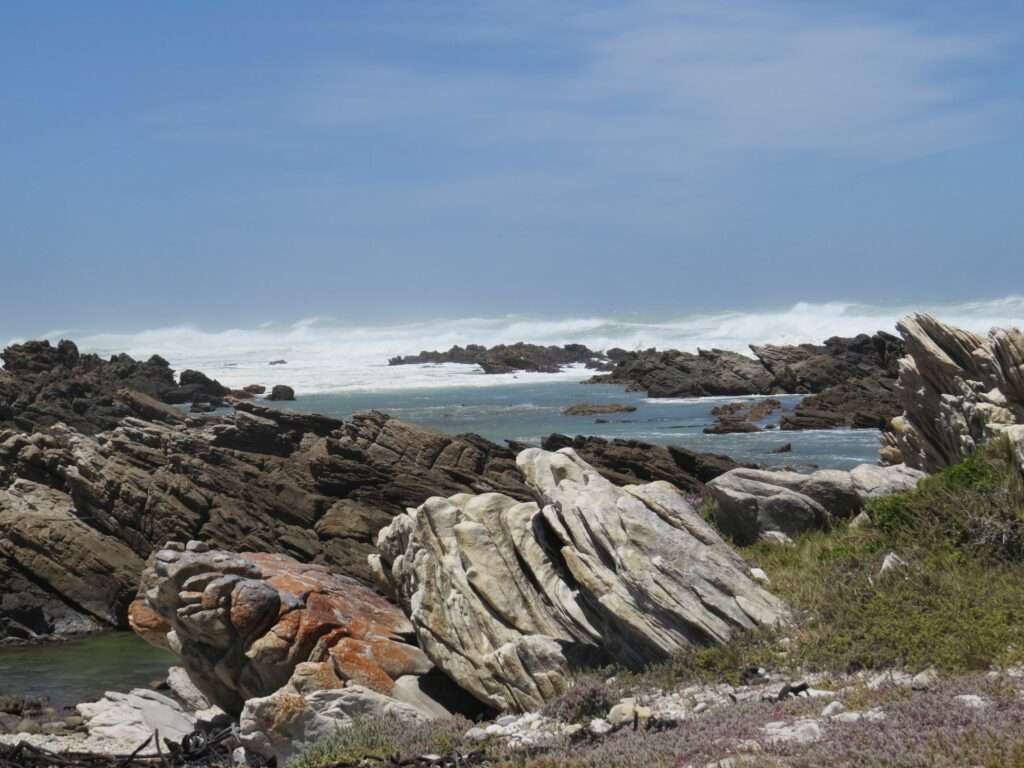
L’Agulhas is a small coastal town located at the southern tip of South Africa in the Western Cape. The town lies near Cape Agulhas, where the Atlantic Ocean and Indian Ocean officially meet. It is situated about 30 km south of Bredasdorp and forms part of the Cape Agulhas Local Municipality in the Overberg region.
History of L’Agulhas
Portuguese explorers discovered L’Agulhas in the early 1400s. In May 1488, Bartholomew Dias named the area Cabo dos Agulhas, or “Cape of Needles.” The southernmost tip of Africa is located at 34°49’58” south and 20°00’12” east.
Many of the original inhabitants of Cape Agulhas were sailors who had been shipwrecked in the area. Over time, a town developed, named “L’Agulhas” due to the influence of French settlers. L’Agulhas, the southernmost village in Africa, gets its name from the Portuguese word for “needles.” This name could refer to either the sharp rocks that caused numerous shipwrecks or the fact that a compass needle points due north here with no magnetic deviation.
The shallow Agulhas Bank extends 250 km south from the tip of Africa before plunging into the deep ocean. The seas off Cape Agulhas are notorious for winter storms, with waves reaching up to 30 meters in height. These treacherous conditions have led to at least 150 shipwrecks in the area. Find a list of some of the ships that have wrecked near Cape Agulhas
Meeting of the Oceans
The meeting point between the warm Indian Ocean and the cold Atlantic Ocean is not actually fixed. It shifts with the seasons due to changing ocean currents and temperatures. This boundary moves between Cape Agulhas and Cape Point, a stretch of about 150 km. The position is mainly influenced by the warm Agulhas Current from the east and the cold Benguela Current from the west.
In summer, the Agulhas Current often pushes farther west, sometimes reaching Cape Point. In winter, the colder Benguela waters shift the boundary back east toward Agulhas.
This seasonal interaction affects local weather and marine biodiversity and contributes to the rough seas and shipwreck history along the coast.
Lighthouse
The L’Agulhas lighthouse, which first shone on March 1, 1849, is the second-oldest in South Africa. Colonel Charles Cornwell Michel designed it, and its flame, fueled by sheep tail fat, burned for 100 years. The lighthouse was electrified in 1936, but weathering forced restoration work in 1968. In 1973, it was declared a national monument. The lighthouse was fully renovated and automated in 1988, and it now houses the only lighthouse museum in the country. Despite its 27-meter height, it has not prevented all shipwrecks, with many wrecks still lying at the bottom of the ocean near the dangerous Agulhas Reef. Some of these remains are on display at the Shipwreck Museum in Bredasdorp.
Southernmost wine route
The Agulhas wine triangle was first established by local vintners in 2019. It includes the villages of Elim, Malgas, Swellendam and Napier. The local terroir is a big factor at the southernmost point of Africa. The proximity to the sea brings fresh cool breezes. The ancient sandstone and chalkstone content aspect brings a depth of character to the varieties. Elim and Napier fall within the Cape Agulhas wine district, where the Indian and Atlantic oceans meet. The unique terroir allows for the production of varieties such as Sémillon and Shiraz. Find a list of wine farms in the region and read about wine-making in the Western Cape
The postcode for L’Agulhas is 7287 (Streets and Boxes)
Things to See and Do in L’Agulhas
- A visit to the lighthouse, with a view from the tower
- Take a guided walking tour with Voice Map
- Shipwreck of Meisho Maru
- Parkrun Cnr Hangness Street & George Street, 8.00 am every Saturday
- Relief map of Africa at Agulhas National Park
- The musical Pebble Beach of Suiderstrand. Visit on a quiet morning to listen to the waves wash over the pebbles, which makes a beautiful sound
Resources
Practical information for the Western Cape, Regulations, permits and helpful tips. See the Colourdots coastal and nature use guide
Getting there
Driving from Cape Town to Cape Agulhas takes around 2h 35m. There are also taxi options if you take a bus to Caledon or Riviersonderend
Explore more of L’Agulhas

Useful Numbers in L’Agulhas
Residents and visitors can find important local contact numbers below, including police, medical services, utilities, and community facilities
-
Emergency Services
- Police: Struisbaai 028 435 6440
- Fire: 028 425 1690 Bredasdorp
- Ambulance: 10177
-
Medical
- Closest hospital;Struisbaai Clinic-028 435 7548
- Pharmacy;Struisbaai Pharmacy-028 435 6913
-
Municipal & Utilities
- Municipality; 028 425 5500
- Water: 028 425 5500
- Electricity: 028 425 5500
-
Transport & Roads
- Traffic department: Bredasdorp Traffic Department-028 424 2440
- Road Emergencies / SANRAL: 0800 204 204
- Childline-116
-
Community & Safety
- 24 hour Poisons Information Helpline of the Western Cape: 0861 555 777.
- NSRI 087 094 9774
- SPCA: AACL Bredasdorp-082 898 0787
-
Local Contacts and Community Resources
- Walking club: 083 233 4084
- Tourism: 0284242584
- Museum; Lighthouse museum-028 435 6078
- Post office; Struisbaai postal agency 028 435 6871
- Library: Struisbaai 028 435 6538
-
Schools in L’Agulhas
- Zoetendal Academy – Agulhas-028 435 6556
Towns and villages in the L’Agulhas municipality are Arniston, Bredasdorp, Hotagterklip, Napier, and Struisbaai
- Colourdots is an independent regional information resource for the Western Cape.
Learn more about the project HERE