- Province: Western Cape
- District: West Coast
- Coordinates:32°41′S 18°53′E
- Area:0.85 km2
- Municipality: Bergrivier
Jump to: History of Eendekuil |Useful Numbers in Eendekuil
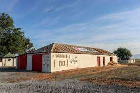
Eendekuil is a rural town located in the West Coast District Municipality, approximately 145 km north of Cape Town. It sits along the R27 regional route, which connects it to Piketburg to the east and the coastal town of Velddrif to the west. The town is surrounded by agricultural land, particularly wheat and grain farms, typical of the Swartland region
History of Eendekuil
Eendekuil, just at the bottom of the Piekenierskloof pass, means “duck shelter” The name is assumed to come from the large numbers of aquatic birds, particularly wild ducks, that congregate at the nearby vleis. It is about 30 km from Piketburg, and it was the terminus of the Cape Town railway until the end of the Anglo-Boer War in 1902. It is still the railhead for the Citrusdal region on the opposite side of the Olifants River. The village is well known for the quality of cheese produced at a local factory. Milk is transported to the factory from many farms in the area. In season, Eendekuil is surrounded by bright yellow fields of canola flowers
The postcode for Endekuil is 7335 (Boxes only)
Resources
Practical information for the Western Cape, Regulations, permits and helpful tips. See the Colourdots coastal and nature use guide
WEATHER IN ENDEKUIL TODAY
Browse businesses and places to visit in Endekuil

Useful Numbers in Eendekuil
Residents and visitors can find important local contact numbers below, including police, medical services, utilities, and community facilities
-
Emergency Services
- General emergency 083 272 4137
- Police: 022 942 1600
- Fire: 022 433 8700
- Ambulance:10177
-
Medical
- Closest hospital; satellite clinic 022 942 1562
- Pharmacy; Porterville Alpha Pharm 022 931 2121
-
Municipal & Utilities
- Municipality 022 942 1780
- Water: 022 942 1780
- Electricity:022 942 1780
-
Transport & Roads
- Traffic department:022 913 2372
-
Community & Safety
- NSRI 087 094 9774
- 24-hour Poisons Information Helpline of the Western Cape: 0861 555 777.
- Childline South Africa: 116
- SPCA: West coast 022 289 0998
-
Local Contacts and Community Resources
- Post office; post agency 022942 1700
- Library: citrusdal022 921 2181
-
Schools in Eendekkuil
- Eendekuil Primary School 022 942 1760
Other towns in the Berg River municipality include: Aurora, Dwaskersbos, Goedverwacht and Porterville
- Colourdots is an independent regional information resource for the Western Cape.
Learn more about the project HERE