History of Piketberg
- Province: Western Cape
- West Coast
- Coordinates:32°54′S 18°46′E
- Area:13.27 km
- Municipality: Bergrivier
Piketberg was founded in the early 1700s
This village is at the foot of the Piketberg mountains which are made up of Table Mountain Sandstone. The area was originally known as Piquetberg and the area was inhabited by Khoi people for thousands of years before the Europeans arrived in the early 1700s. There are well-preserved examples of San rock art in the mountains. A new Dutch Reformed parish was established here in 1833.
Two years later the government granted permission for the farm Grootfontein to be used to establish a town, the first stands went up for sale in 1841. The railway reached the village in1902. European families arrived in 1705 and by 1730 there were 35 farming families in the area. The VOC established and manned a military post to help protect their livestock from theft by the local indigenous Khoi.
The area is conducive to wheat farming on the plain and rooibos tea grows well on the mountain slopes.
Piketberg had a fairly big Jewish community, mostly Lithuanian immigrants, and a synagogue was built by them in 1925. The congregation eventually disbanded and the building is currently used as the tourism bureau.
The local community used a cannon to announce the arrival of ships. When the cannon sounded, the farmers would bring their produce for transport and sale in Cape Town. The cannon was fired for the last time in 1961 at the proclamation of South Africa as a republic. One of these canons stands at the local high school.
The license plate prefix for Picketberg is CBY and the postal code is 7320
WEATHER IN PIKETBERG TODAY
SEE ALL LISTINGS IN PIKETBERG
Things to see and do in Piketberg
- Versveld pass
- At the foot of Versvelds Pass is an old water mill that is now a national monument
- Cultural history museum
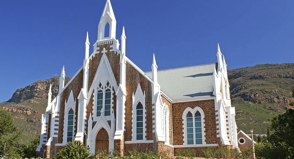
- Picketberg Dutch Reformed Church designed by Carl Otto Hager and built in the 1880s
- Piket-Bo-Berg market
- On the Last Friday of every month, there is a festival of live music, food and drink specials, and art gallery exhibition openings.
- The Piketberg Gravel Bike Circuit
- One of the oldest cement factories is just west of the town at De Hoek. PPC cement converted the lime plant into a cement factory and 3 million tons of earth are moved each year
- Discover historic Piketberg. Following a self-guided route through town. Experience the rich history and historic buildings in the village. Start at the Tourism offices and collect a map of the Route. The route includes the Neo-Gothic Dutch-Reformed Church, built in 1882, the Commercial Hotel, built in 1898, the Sheriff’s Office, and the original Police Station, which were both built in 1926. Also, the original movie theatre that was built in the early 1920s.
Useful Numbers
- Police: 044 803 4400
- Municipality-044 606 5266
- Traffic department:-George Traffic Department-044 878 2400
- Fire: George Brandweer and Nooddienste-044 801 6311
- Water: 044 606 5266
- Electricity: 044 606 5266
- Ambulance: 10177
- Post office; Grootbrakrivier Post Office-044 620 2201
- Library: George Library-044 801 9288
- Closest hospital; George Hospital-ER-044 874 5122
- Pharmacy; Grootbrak Chemist-044 620 2511
- SPCA: Garden Route SPCA-044 693 0824
- Piketberg Crime protection forum:022 913 8800 piketbergcpf@gmail.com
- Local paper” Die Courant”: 022 487 3221
- Swartland Gazette: 022 482 3817
- Tourism Padstal Building, Winkelshoek Complex, Tel: 022 – 913 2063
- Schools
- Hoogekraal Primary School-044 879 1297
- Van Der Hoven Primary School-044 876 0133
- Diepkloof VGK Primary School-044 876 0147


