Towns in the Central Karoo Districts and Municipalities
Central Karoo
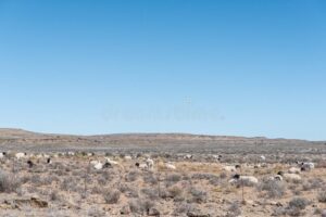
The Central Karoo is the largest and most sparsely populated district in the Western Cape. It lies in the semi-arid interior of South Africa and is known for wide open landscapes, sheep farming, and small historic towns along major travel routes such as the N1. The district covers vast distances and includes three local municipalities: Beaufort West, Laingsburg, and Prince Albert.
Beaufort West Municipality
Beaufort West Municipality is the oldest municipality in South Africa and is often referred to as the capital of the Karoo. The municipality covers approximately 16,673 km².
Towns in the Beaufort West Municipality include: Beaufort West, Merweville, Murraysberg, and Nelspoort
Agriculture and tourism form the backbone of the local economy, with Beaufort West serving as a major stop along the N1 highway through the Karoo.
Laingsburg Municipality
Laingsburg Municipality spans an area of approximately 8,784 km² and includes just Laingsburg, and Matjiesfontein in the semi-arid Karoo. Its position on the N1 national road, which connects Cape Town and Johannesburg, gives the area strategic importance. It lies about 280 km from Cape Town. The town was almost destroyed by a devastating flood in 1981 and was later rebuilt. Today, it is a small but modern Karoo town and a convenient stop for travellers along the N1. The main economic sectors are agriculture and tourism
Prince Albert Municipality
Prince Albert Municipality forms part of the Central Karoo District in the Western Cape. The municipality covers an area of approximately 8,153 km² and includes several small Karoo towns and surrounding farming areas. Towns in the Prince Albert Municipality include: Klaarstroom, Prince Albert, Prince Albert Road and Leeu-Gamka. Agriculture and tourism play an important role in the local economy, with Prince Albert itself known for its well-preserved Karoo architecture and location near the Swartberg Mountains.