On this page
- History of Simon’s Town
- Things to See and Do in Simon’s Town
- Location and Administrative Information
- Browse Businesses and Places to Visit in Simon’s Town
- Useful Numbers and Local Information in Simon’s Town
Simon’s Town is a historic coastal town on the False Bay coast of the Western Cape, about 40 km from Cape Town along the M4 coastal route between Fish Hoek and Cape Point. It lies within the Table Mountain National Park area and forms part of the City of Cape Town municipality. The town is known for its naval history, maritime museums, heritage buildings and nearby attractions such as Boulders Beach penguin colony. It also provides access to beaches, walking routes and local services. This guide covers things to do, historical background, museums, transport and useful local information for visitors and residents.
History of Simon’s Town
Naval Base in False Bay
In 1687, Simon van der Stel surveyed the area to find a safe winter anchorage for ships. During the winter months, Table Bay is battered with violent northwesterly gales, which, until a safe harbour was built in Cape Town, caused havoc with ships in the bay. He chose Yzelstein’s Bay and renamed it after himself. It remained the Cape winter anchorage until the breakwater was built at Table Bay.
Simon’s Town has been a naval base for over 200 years. First, the Dutch East India Company built a dockyard in 1743. The British later took it over in the 1790s.
The facility developed gradually, and in 1898, when it became apparent that a larger space was needed, construction of the modern harbour began. The harbour /docks area covers over 11 hectares and includes a breakwater and drydock facilities.
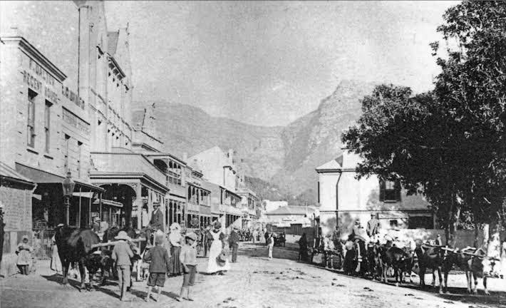
St. George’s Street, late 1800s
The Simon’s Town agreement saw it transferred to the South African Navy in 1957
There are quaint old Victorian buildings and walkways with little shops in Simon’s Town, along with interesting historical sites and museums, making it a lovely place to visit. The railway line from Kalk Bay to Simon’s Town started in 1889 and was completed and opened on 1 December 1890. The line was electrified with overhead catenary in 1928.
Toll gate
In 1793 a toll gate operated at Kalk Bay, charging 6 shillings for a coach and 1 shilling for a saddled or led horse. A second toll gate was later established at Simon’s Town, with records indicating it opened around 1801. The Kalk Bay toll was eventually abandoned in 1815, and traffic was directed through the Simon’s Town toll instead, which remained in use until 15 August 1901.
The gate stood at a narrow section of the Main Road near the present junction with Jubilee Street. A wooden barrier stretched from the Admiralty House wall across the road to the toll house, controlling movement toward Simon’s Town as well as the Red Hill and Wildschutsbrand routes. The fees collected were used to maintain the road.
Local stories say an admiral created an additional gateway in the Admiralty House wall to avoid paying the toll. Officers riding on horseback in uniform were exempt, although the exemption did not apply if they travelled by carriage.
The Fish Spotter for Trek Fishing
The fish spotter, or “sighter,” played a vital role in the traditional trek fishing industry. At one point, Simonstown was home to eight trek fishing families operating from Smitswinkel Bay near Cape Point to Glencairn. They would go out two or three times a day — sometimes even at night when fish were plentiful — to earn their daily living.
The sighter’s job was crucial. He would climb the mountain early each morning with his lunch, two flags, a whistle, and binoculars. From his high vantage point, he would scan the coastline for shoals of fish. These were highly experienced fishermen, often able to identify both the type and quantity of fish in the water just by reading the sea’s movements.
When a shoal was spotted, the sighter would blow his whistle and use flag signals to guide the skipper to the exact location to cast the net. With their expertise, missed catches were rare.
Sadly, as apartheid policies took hold, these trek fishing operations were systematically shut down. The closure marked the loss of a livelihood, a way of life, and a deep-rooted fishing tradition.
Things to See and Do in Simon’s Town
-
Walks and hikes
- Take a guided walking tour
- Swartkop Peak at 678 m. Hike starts on Jan Smuts Drive in Seaforth. It is one of the best hikes; you get a 360-degree view over False Bay.
- Ghost walk 076 190 4081
- Voicemap walking tour audio
-
Museums
- The South African Naval Museum houses a collection of maritime artefacts from the history of the SA Navy. The interior of a submarine and a ship’s bridge move to mimic the feel of waves on the sea. Admission is free; however, donations are welcome
- The Simon’s Town Museum was established in the Residency in 1977. This building was established in 1777 by Governor Joachim van Plettenberg. There is an exhibit that chronicles the story of just nuisance -021 786 3046
- Warrior Toy Museum and Collectors Shop -021 786 1395
- The Heritage Museum reflects the history of the Muslim Community in King George’s Way.-021 786 2302
-
Beaches
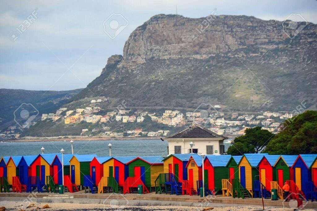
- Boulders Beach, south of Simon’s Town, is home to one of just three colonies of African penguins, which have made their home there since 1985. Take a guided walking tour
- Glencairn
- Seaforth
-
Heritage sites
- The British built a round 8-metre-high Martello Tower with walls 1.8 metres thick, within the Naval base shortly after it had annexed the Cape of Good Hope. This was a defence to ward off possible attacks by the Dutch or French. Today, it houses a small museum.
- In 1886, the first public jetty using light timber was built. In 1905, this jetty was replaced using heavier timber. In 1921, reinforced concrete was used. It is one of the oldest structures of its type still in use today.
- Stempastorie 139 St George’s St, Built in 1899 as a DRC rectory. The music for “Die Stem”, now part of South Africa’s national anthem, was composed here in 1919 by Reverend M.L. de Villiers.
- Dockyard church, the oldest English church in South Africa, was consecrated in 1814.
- Remains of The Simon’s Town Aerial Ropeway.
- Simon’s Town docks
- Red Hill Village Ruins
- Simon’s Town railway station was built before the line reached Simon’s Town. The final extension of the railway line from Kalk Bay to Simon’s Town started in 1889 and was completed and opened on 1 December 1890. The line was electrified in 1928.
- Admiralty House was built in 1740 by Antoni Visser, a former Dutch soldier who became the unofficial representative of the VOC at Simon’s Town. It is one of the oldest buildings in Simon’s Town.
- A statue of Just Nuisance, a beer-drinking Great Dane who was in the 1930s, the only dog ever to be officially enlisted in the Royal Navy, can be seen overlooking the harbour.
- A commemorative plaque in Simon’s Town today marks the visit of the CSS Alabama,
- From Barnard Street, there is a long, well-constructed 340-step staircase, originally built to service the Signal School above on the Klaver Valley
Other
- The South African Navy Festival, held annually in October at the East Dockyard
- Blackhill pass
Browse Businesses and Places to Visit in Simon’s Town
Find details about attractions, heritage sites, businesses and local stories. Click the listings HERE

Location and Administrative Information
- Province: Western Cape
- Coordinates: 34°11′36″S 18°26′00″E
- Municipality: City of Cape Town
- Area: 19.81 km2
Useful Numbers and Local Information
in Simon’s Town
Transport
Metrorail, Golden Arrow Bus Services, and minibus taxis serve Simon’s Town. See linked pages for details—other options for getting around the Western Cape.
Weather in Simon’s Town today
The Postal code or Simon’s Town is 7995
Resources
For permits, fishing rules, shell collecting regulations and other practical outdoor information relevant to Simon’s Town, see the Colourdots coastal and nature use guide
-
Emergency Services
- Police: 021 786 8646
- Ambulance: 10177
-
Medical
- Closest hospital: False Bay Hospital 021 782 1121
Institute for Maritime Medicine Military Hospital 021 787 4497 - Pharmacy; 021 786 2133
-
Municipal & Utilities
- Water: 08601033089
- Electricity: 08601033089
-
Transport & Roads
- Traffic department: 021 786 8646
- Road Emergencies / SANRAL: 0800 204 204
-
Community & Safety
- NSRI (Sea Rescue): 087 094 9774
- Childline South Africa: 116
- SPCA: 021 700 4140
-
Local Contacts and Community Resources in Simon’s Town
- Library: 021 786 1553
- Museum; 021 786 3046
- Civic Centre: 021 444 6948
- .Community hall; 021 702 6071
- Tourism 021 786 8440
-
Schools in Simon’s Town
- Simon’s Town School, Grade R to Grade 12 021 786 1056
- Find a comprehensive list of Cape Town Emergency numbers HERE
The City of Cape Town Public Emergency Communication Centre is available 24/7 for all life or property-threatening emergencies. Call 021 480 7700 from any phone or 107 from a landline or report online at https://bit.ly/3o4Ji3K
- Colourdots is an independent regional information resource for the Western Cape.
Learn more about the project HERE
Updated November 2025