- Coordinates: 33°54′S 18°57′E
- Province: Western Cape
- District: Cape Winelands
- Municipality: Stellenbosch
- Area: 0.59 km2
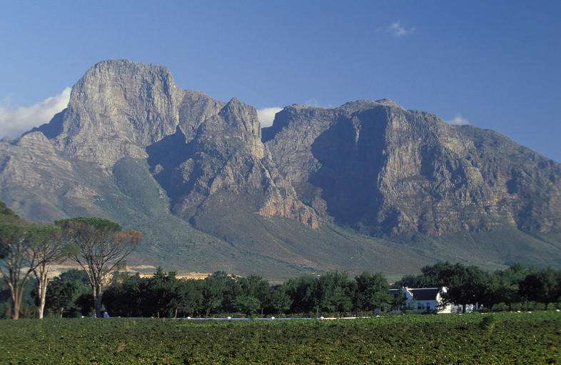
Pniel is located along the R45 (Franschhoek Road), approximately 10 km north of Stellenbosch and about 8 km south of Franschhoek. The village sits in a fertile valley below the Simonsberg mountain range, surrounded by vineyards, farms, and rural estates.
Nearby settlements include Kylemore, Johannesdal, and Lanquedoc, with easy access to both the Franschhoek Pass and the Helshoogte Pass toward Stellenbosch.
History of Pniel
Origins of the village
The village is a historic settlement nestled in the Western Cape province of South Africa. It traces its origins back to the early 19th century. Established by the London Missionary Society in 1818, the village holds significant cultural and historical importance in the region. Its name, meaning Face of God, reflects the community’s enduring spiritual heritage.
A piece of land from the farm De Goede Hoop was donated by 2 Huguenot farmers, Pieter Isaac de Villiers and Paul Retief, to build a self-supporting mission settlement for homeless and landless slaves after 1842, when slavery was abolished by the British Empire. There had been about 40 000 slaves in South Africa. These two farmers also bought a neighbouring farm, which had been called Papiermole,n which was included in the settlement. The land was subdivided into 99 small plots on which the freed slaves could build houses and plant food gardens.
Mission beginnings of the town
The mission was run by the United Congregational Church of Southern Africa (UCCSA). A church and a school were built for the community. The name Pniël is of biblical origin and refers to the place where Jacob wrestled with God.
Local Economy
Fruit and vegetable production has become a large industry. It is the major source of income for the town
Today
Pniel is a residential and community-focused village with schools, churches, and local facilities serving residents of the valley. Many residents work in the surrounding agricultural and tourism industries, particularly wine farms and hospitality establishments in the Franschhoek and Stellenbosch areas.
The village remains small and close-knit, retaining its rural character while being close to major wine tourism
The postcode here is 7681
Things to see and do in Pniel
- Helshoogte pass
- The Pumpkin Festival takes place in March. Weigh-ins of giant pumpkins with carving contests, live music, local crafts and food.
- Hike to Pniel Silver mine caves in the Simonsberg mountain 0844284620
Resources
Practical information for the Western Cape: regulations, permits, and helpful tips. See the Colourdots coastal and nature use guide
local WEATHER TODAY
Browse businesses and places to visit in pniel

Useful Numbers
Residents and visitors can find important local contact numbers below, including police, medical services, utilities, and community facilities in and around
-
Emergency Services
- Police: Cloetesville 021 888 5940
- Law Enforcement:021 808 8890
- Fire: 021 808 8888
- Ambulance: 10177
-
Medical
- Closest hospital: Optima Rustenvrede Hospital- 021 885 2222
- Pharmacy; Die Boord pharmacy: 021 887 9400
-
Municipal & Utilities
- Municipality: 021 808 8111
- 24-Hour Emergency line:Tel: 021 808 8890
- `Water: 021 808 8215/021 808 8953
- Electricity: 021 808 8215/021 808 8953
-
Transport & Roads
- Traffic department: 021 808 8800
- Community & Safety
- SPCA: Stellenbosch animal welfare 021 883 9129
- NSRI 087 094 9774
-
Local Contacts and Community Resources in Pniel
- Post office; 021 883 2233
- Library: 021 808 8499
- Museum; 021 885 2645 https://www.facebook.com/pages/Pniel-Museum/268491883295194
-
Schools in Pniel
- Pniel Primary 021 885 1110
- Colourdots is an independent regional information resource for the Western Cape.
Learn more about the project HERE