- Province: Western Cape
- District: Garden Route
- Coordinates:34°00′S 23°27′E
- Area:9.75 km2
- Municipality – Bitou
Jump to: History of Keurbooms River |Things to see and do in Keurbooms River |Useful Numbers in Keurbooms River
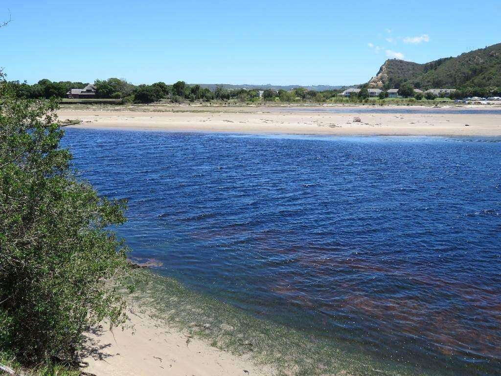
Keurbooms River is a scenic river in the Garden Route of the Western Cape, near Plettenberg Bay. It rises in the Langkloof near Uniondale and flows southeast through the Outeniqua and Tsitsikamma mountain ranges before entering the Indian Ocean at Keurbooms Lagoon. The river runs past areas such as De Vlugt and the Prince Alfred Pass and is surrounded by indigenous forest, steep gorges, and protected natural landscapes.
History of Keurbooms River
The Keurbooms River takes its name from the keurboom tree, which grows naturally along its banks. The area has a long history of human occupation, with archaeological evidence found at the nearby Matjes River Rock Shelter dating back around 11,000 years to the Later Stone Age. The site contains one of the largest shell middens in the world, providing insight into early coastal communities and their way of life.
In 1630, survivors of the Portuguese ship São Gonçalo were stranded in the area for several months, becoming some of the earliest Europeans to live along this stretch of coastline. Over time, the river remained largely undeveloped, preserving its natural character and surrounding forests.
Today, the Keurbooms River and its surrounding areas form part of a protected environment, including the Keurbooms River Nature Reserve, which is recognised as a World Heritage Site. The river supports a diverse ecosystem, including indigenous fish such as the Cape galaxias, as well as birdlife and forest species typical of the Garden Route region.
The postcode for Keurbooms River is 6600
Things to see and do in Keurbooms River
- Guided boat trip on the river 069 733 0410.
- Cathedral Rock, also known as Arch Rock, is a stunning rock formation
- Keurbooms Lagoon
- Keurbooms Nature Reserve.
- The Matjes River Rock Shelter, where the large middens were found, is a national monument.
Resources
Practical information for the Western Cape, Regulations, permits and helpful tips. See the Colourdots coastal and nature use guide
WEATHER IN KEURBOOMS RIVER
Browse businesses and places to visit in KEURBOOMS RIVER

Useful Numbers in Keurbooms River
Residents and visitors can find important local contact numbers below, including police, medical services, utilities, and community facilities
-
Emergency Services
- Police:044 501 1900
- Fire: Bitou Municipality Fire Services-044 533 5000
- Ambulance: 10177
-
Medical
- Closest hospital;Mediclinic Plettenberg Bay-044 501 5100
- Pharmacy; Main St -044 533 1370
-
Municipal & Utilities
- Municipality;044 501 3000
- Water: 044 501 3000
- Electricity:044 501 3000
-
Transport & Roads
- Traffic department:044 501 3240 / 3251
- Road Emergencies / SANRAL: 0800 204 204
-
Community & Safety
- Childline-116
- 24-hour Poisons Information Helpline of the Western Cape: 0861 555 777.
- NSRI 087 094 9774
- SPCA: Garden Route SPCA-044 693 0824
-
Local Contacts and Community Resources
- Post office;044 533 1260
- Library: New Horizons Public Library-044 501 3128
-
Schools close to Keurbooms River
- Plettenberg Bay Primary School-044 533 2126
- Plett Pre Primary School-044 533 2542
- Colourdots is an independent regional information resource for the Western Cape.
Learn more about the project HERE