- Province: Western Cape
- Winelands
- Coordinates: 33°24′47″S 19°12′06″E
- Area: 5.0 km2
- Municipality: Witzenberg
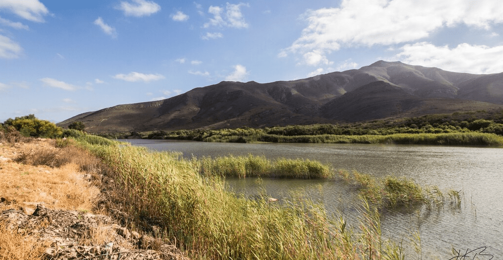
Wolseley is in the Breede River Valley of the Western Cape, about 90 kilometres north-east of Cape Town. The town lies south of Ceres and east of Tulbagh, with the Witzenberg Mountains forming part of the surrounding landscape. It is accessed via the R43 and R46 routes and sits near the Mitchells Pass connection between Ceres and the broader valley region. The area is known for fruit farming, vineyards and mountain scenery, forming part of the wider Cape Winelands region.
History of Wolseley
This town was founded in 1875 on the farm Goedgevonden (Well found) and named after Sir Garnet Wolseley, who was the governor of Natal and the supreme commander of the British forces at the time.
Fruit industry in Wolseley
The village was first developed as a railhead for the local fruit growers. The line reached Wolseley in1876. Soon, the village developed a small yet thriving industrial base.
Many of the town’s buildings were damaged in the 1969 earthquake.
The Cape Orchard Company was begun here by Leicester Dicey in the 1890s. He and his cousin built up a large fruit-growing industry, along with supporting industries such as wooden crate building in the area. Tree nurseries were also established to grow strong trees. Railway lines were extended to Wolseley to transport the fruit to Cape Town.
The first wool washery in the country was built here, and the first fruit cannery opened in 1936
Anglo-Boer War blockhouses
Stone blockhouses in the area were built by the British during the Anglo-Boer War in 1901 to protect the Railway bridges. Many of these require repair, but the local blockhouses are remarkably intact
The postcode for Wolseley is 6830.
Resources
Practical information for the Western Cape, Regulations, permits and helpful tips. See the Colourdots coastal and nature use guide
local WEATHER TODAY
Browse businesses and places to visit in Wolseley

Useful Numbers
Residents and visitors can find important local contact numbers below, including police, medical services, utilities, and community facilities
-
Emergency Services
- Police: 023 231 8000
- Fire: 023 316 1997/8
- Ambulance: 10177 or Tulbagh-023 230 1326:
-
Medical
- Clinic; 023 231 1320
- Pharmacy; Ceres-023 316 1233
-
Municipal & Utilities
- Water: 023 3168547
- Electricity; 023 3168540:
-
Transport & Roads
- Traffic department: Ceres 023 316 1997
-
Community & Safety
- S.P.C.A ; Wellington-021 864 3726
- NSRI 087 094 9774
-
Local Contacts and Community Resources
- Tourism; 082 835 7625
- Post office; 023 231 0310
- Library; 023 316 1854
-
Schools in Wolseley
- Wolseley Secondary School-023 231 1120
- Witzenberg Primary School-023 231 0138
- Wolseley Primary School-023 231 0122
- W.F. Loots Primary School-023 231 0155
- Errie Moller Primary School-023 231 0382
- Colourdots is an independent regional information resource for the Western Cape.
Learn more about the project HERE