- Province: Western Cape
- District: Cape Winelands
- Coordinates:33°01′S 19°17′E
- Area:1.04 km2
- Municipality: Witzenberg
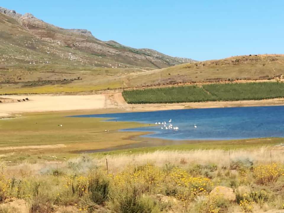
Op die Berg is situated in the Koue Bokkeveld region of the Western Cape, north of Ceres and reached via the Gydo Pass. The town lies on a high plateau surrounded by the Skurweberg and Witzenberg mountain ranges. It forms part of a productive deciduous fruit-growing area and acts as a service centre for farms scattered across the interior valleys between Ceres, Citrusdal and the Tankwa Karoo.
History of Op Die Berg
Op-die-Berg is a small rural town in the Koue Bokkeveld, near Citrusdal and north of Ceres. The settlement has a few essential services, including churches, a school, a supermarket and a restaurant. The surrounding mountains are also known for well-preserved San rock art sites. Cherry orchards flourish in the area, and winter can bring heavy snowfalls.
Founded only in 1961, Op-die-Berg is one of the youngest towns in South Africa. The name refers to the Skurweberg on which the settlement stands. Despite its size, it serves as an important agricultural hub for a wide farming region with a radius of about 120 km. More than 60 farms depend on the town, and most produce deciduous fruit.
Like many rural towns, Op-die-Berg began with a church. Before permission was granted on 25 November 1961, residents had to travel about 50 km to Ceres via the then-gravel Gydo Pass to attend services. Farmers also used this difficult route to transport livestock and produce to facilities in Ceres.
Once the congregation was established, the town followed. The 300-hectare site was originally part of the farm Remhoogte, owned by Heinie du Toit and Stokkies Hanekom. Although the congregation separated in 1961, the church building was not completed in 1966. During those five years, the Du Toit family of De Keur made a barn available for services, complete with a pulpit and small organ.
A farming community also required a co-operative. While the church was being organised, a branch of the Porterville Landbou-koöperasie opened in the settlement. It later amalgamated with Boland Agri Worcester, reinforcing Op-die-Berg’s role as the service centre for the surrounding farms.,
The postcode is 6836
Resources
Practical information for the Western Cape: regulations, permits, and helpful tips. See the Colourdots coastal and nature use guide
WEATHER in op die berg TODAY
Browse businesses and places to visit in op die berg
 Useful Numbers
Residents and visitors can find important local contact numbers below, including police, medical services, utilities, and community facilities
-
Emergency Services
- Police: 023 317 0326
- Fire and rescue: 023 3161854
- `Ambulance: 10177
-
Medical
- Closest hospital; Clinic-023 317 0380
-
Municipal & Utilities
- Municipality Ceres-023 316 1854
-
Transport & Roads
- Traffic department:023 316 8165
-
Community & Safety
- NSRI 087 094 9774
- S.P.C.A – Wellington-021 864 3726
-
Local Contacts and Community Resources
- Post office;Tulbagh Post Office-023 230 0001
- Public library-Saron Library-023 240 0015
-
Schools in Op Die Berg
- Koue Bokkeveld Opleidingsentrum-023 317 0983
- Skurweberg Secondary School- 0233170916
- Colourdots is an independent regional information resource for the Western Cape.
Learn more about the project HERE