Malmesbury

Malmesbury is a major town in the Swartland region of the Western Cape. Surrounded by wheat fields and vineyards, it serves as an important agricultural and commercial center north of Cape Town.

Malmesbury

Malmesbury is a town located in the Swartland of the Western Cape, about 65 kilometres north of Cape Town. The town lies along the N7 highway, which connects Cape Town with the northern parts of South Africa and Namibia. Malmesbury is surrounded by the rolling wheat fields and farmland that characterise the Swartland region, making it an important agricultural centre for grain production, livestock farming, and vineyards. The nearby Diep River flows through the surrounding countryside, while low hills and fertile plains support extensive farming activities. Because of its strategic position along major transport routes and within the Swartland agricultural belt, Malmesbury serves as a commercial and administrative hub for nearby rural communities and farms.

History of Malmesbury

The Heart of South Africa’s Grain-Growing Industry

This historic town has deep roots in South Africa’s agricultural heritage. It was once known as “Het Zwarte Land,” a name coined by Jan Van Riebeek. The name referred to the area’s vegetation, particularly the Renosterbos, which turns black during the hot summer months.

Ancient Inhabitants and Early European Settlers

For centuries, the Khoi people inhabited the region. European settlers began to arrive in the 1700s, drawn by the area’s hot sulfur springs, which were renowned for their ability to cure rheumatism. Unfortunately, these curative springs were never fully developed; instead, a shopping centre was built on the site, with a fountain marking the original location of the springs.

Early Farms 

The first farms in the area were allocated in 1703. The Dutch Reformed Church (NG Kerk) established a congregation known as “Swartlands Kerk.” In 1829, the town was named Malmesbury after the Earl of Malmesbury, father-in-law to Sir Lowry Cole, the Governor of the Cape Colony. Malmesbury gained municipal status in 1860, marking its growth as a key settlement in the region.

Agriculture and Historic Landmarks

The local climate is ideal for grain cultivation, making it the centre of South Africa’s grain-growing industry. Vineyards also thrive in the region, contributing to its agricultural diversity.

Malmesbury is home to several beautiful historic buildings, including a synagogue built in 1911, reflecting the once-thriving Jewish community in the town. Today, Malmesbury continues to play a vital role in South Africa’s agriculture, with its rich history and cultural heritage attracting visitors from near and far.

Transport

Malmesbury is served by Metrorail, Golden Arrow Bus Services, and minibus taxis. See linked pages for details. Other options for getting around the Western Cape.

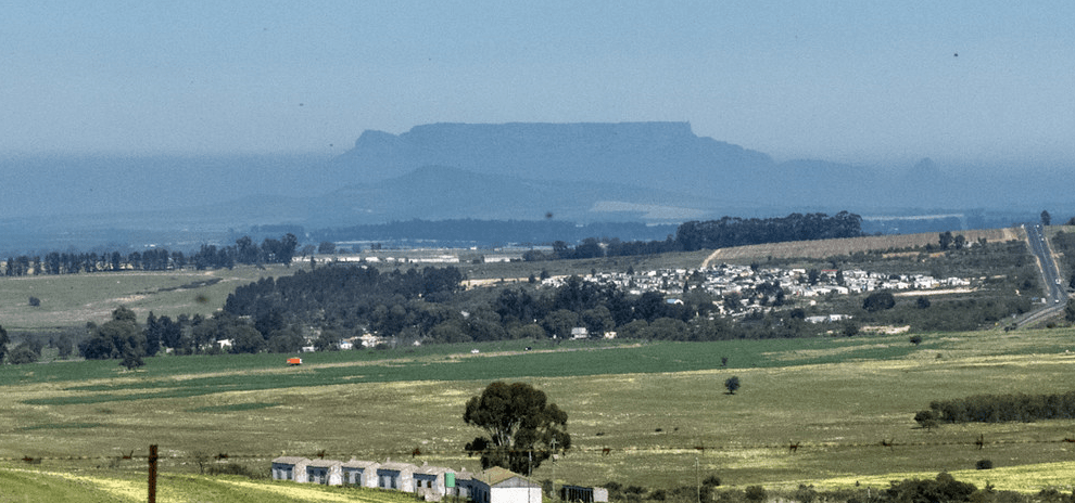
Things to see and do in Malmesbury

  • Historic Walk, see beautifully restored buildings along the “Historic Walkabout Route, these are of interest to historians, architects and tourists. Download brochure 1mb 
  • Parkrun  08:00 every Saturday at ‘Die Bos’ on Barocca St,  malmesbury@parkrun.com
  • The oldest milling company in the country is headquartered here. Bokomo was established in 1919. Tours are offered here.
  • Swartland Birding Route, Swartland Wine and Olive Route.
  • Pinotage and Hanepoot grapes are local specialities.
  • Visit the small village of Philadelphia on the way to Malmesbury from Cape Town
  • Neo-Gothic Dutch Reformed Church, dating back to the early 1860s
  • Masonic Lodge (1866).
  • Communion Well 1750, a series of wells around the Dutch Reformed Church. One of the three remaining wells can be seen in Lewis Stores, Piet Retief St.

Resources

Practical information for the Western Cape, Regulations, permits and helpful tips. See the Colourdots coastal and nature use guide

Useful Numbers

Residents and visitors can find important local contact numbers below, including police, medical services, utilities, and community facilities

  • Emergency Services

  • Police: 022 482 7500
  • Fire: 022 487 9479
  • Emergencies: o/h 022 487 9400 a/h 022 487 9479
  • Ambulance: 022 482 1161 10177
  • Medical

  • Closest hospital: Swartland Hospital 022 482 1161
  • Pharmacy; Geard pharmacy 022 482 2557
  • Municipal & Utilities

  • Municipality 022 482 4370
  • Transport & Roads

  • Traffic department: 022 487 9400
  • Road Emergencies / SANRAL: 0800 204 204
  • Community & Safety

  • Childline-116
  • 24-hour Poisons Information Helpline of the Western Cape:  0861 555 777.
  • NSRI 087 094 9774
  • SPCA: Swartland 022 492 2781
  • Local Contacts and Community Resources 

  • Home affairs: 073 176 8515
  • Post office;022 482 2422
  • Library:022 487 9439
  • Museum; 022 482 233
  • Tourism (0)22 487 1133
  • Local paper” Die Courant”: 022 487 3221
  • Swartland Gazette: 022 482 3817
  • Swaartland Joernaal 071 860 7888
  • Schools in Malmesbury

  •  Swartland High; 022 482 1469
  • Swartland Primary; 022 487 4595
  • Laerskool swartland; 022 482 2251
  • Wesbank secondary; 022 486 4868
  • Liebenburg Primary; 022 486 4595
  • Naphakade primary;081 472 8697
  • Schoonspruit secondary; 022 486 4598
  • Find a comprehensive list of Cape Town Emergency numbers HERE


  • Colourdots is an independent regional information resource for the Western Cape.
    Learn more about the project HERE


Generic selectors
Exact matches only
Search in title
Search in content
Post Type Selectors