- Province: Western Cape
- West Coast
- Coordinates:31°33′S 18°21′E
- Area:2.33 km2
- Municipality: Matzikama
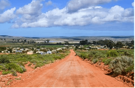
Lutzville and Koekenaap are neighbouring towns located in the northern part of the Western Cape, within the Olifants River Valley. The towns lie a short distance apart along the regional road connecting the farming areas between Vredendaland the West Coast. Both settlements developed primarily as agricultural service centres for surrounding farms, particularly vineyards, citrus orchards, and vegetable production supported by irrigation from the Olifants River. Lutzville is especially known for wine production and hosts the well-known Namaqua Wines cooperative, while Koekenaap serves nearby grain and potato farms. Because of their proximity and shared economy, Lutzville and Koekenaap are often referred to together as part of the same rural community in the Olifants River Valley.
History of Lutzville and Koekenaap
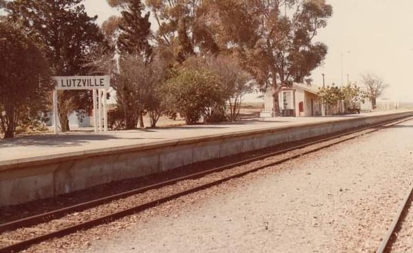
The town of Lutzville was originally named Vlermuisklip (Bat Rock) after a famous landmark rock situated there. It is a rocky overhang that early travellers used as a shelter. This feature was already noted by VOC explorers in the early 1660s when the Olifants River valley was first surveyed. It was declared a national monument. For many years, the area remained sparsely settled, with farming confined to a few riverbank properties, such as Melkboomsdrift, which is dated at 1825.
The twentieth century saw more development when the state expanded irrigation systems along the Olifants River, linking to the Clanwilliam Dam project upstream. Vineyards, table grapes, raisins, tomatoes and vegetables were farmed along the river.
Koekenaap is a short drive away. Lutzville later took its name in honour of John Lutz, who was the chief irrigation engineer who pioneered the Clanwilliam Dam. Lutzville is near the Olifants River, and at high tide, one can take a flat-bottomed boat all the way to Papendorp, 30 km downstream. Before Europeans colonised the Cape, the area around the Olifants River was populated with herds of elephants. The area is famous for quality wine. Colourful spring flowers, vegetables, and the fruit grown on local farms.
The postcode for Lutzville is 8165, Streets and boxes, and for Koekenaap it is 8146
Resources
Practical information for the Western Cape, Regulations, permits and helpful tips. See the Colourdots coastal and nature use guide
WEATHER IN LUTZVILLE AND KOEKENAAP TODAY
Browse businesses and places to visit in Lutzville and koekenaap

Useful Numbers
Residents and visitors can find important local contact numbers below, including police, medical services, utilities, and community facilities
-
Emergency Services
- Police: 027 217 4000
- Ambulance: 10177
-
Medical
- Closest hospital: Vredendal hospital 027 213 2036
- Pharmacy; 027 217 2100
-
Municipal & Utilities
- Municipality 027 201 3442
- Electricity:082 323 7462
-
Transport & Roads
- Road Emergencies / SANRAL: 0800 204 204
-
Community & Safety
- 24 hour Poisons Information Helpline of the Western Cape: 0861 555 777.
- NSRI 087 094 9774
- SPCA:swaartland spca 022 492 278
- Childline-116
-
Local Contacts and Community Resources
- Post office;027 217 1022
- Library: 027 201 3339
- KOEKENAAP Cultural Centre: (027) 217 1349
-
Schools in Lutzville and Koekenaap
- Lutzville high 027 217 1006
- Uitkyk Primary School 027 1080
Other towns in the Matzikama district include Bitterfontein, Doringbaai, Ebenhaeser, Klawer, Strandfontein, Van Rhynsdorp, and Vredendal
- Colourdots is an independent regional information resource for the Western Cape.
Learn more about the project HERE