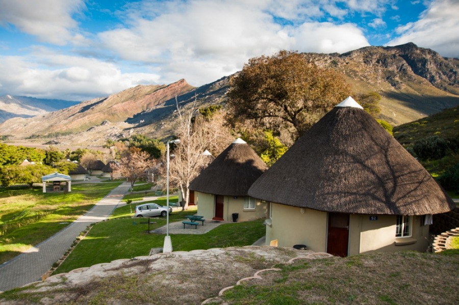
History of Goudini and the spa
The name Goudini is generally recognised as having Khoekhoe origins. One interpretation connects it with “bitter honey”, while other explanations refer to wild honey or honey beer. The precise meaning is uncertain, but the name preserves a trace of an Indigenous language spoken in this part of the Cape before Dutch-speaking farmers occupied the valley.
Goudini originally referred to a much wider landscape than the holiday resort known by that name today. The area forms part of the Breede River Valley, where generations of people lived in close relationship with the rivers, mountains, plants and seasonal grazing.
Before the farms
Before colonial farms were established, the valley formed part of the world of Indigenous southern African communities. Khoekhoe pastoralists moved livestock through the landscape, depending on grazing, seasonal water and relationships between communities. The broader region also has a much older history of San hunter-gatherer occupation.
These were distinct societies, with different ways of life, although their histories sometimes intersected through exchange, kinship, shared landscapes and conflict. The broad label “Khoisan” can obscure these differences.
The plants growing in the valley were also part of a substantial body of Indigenous environmental knowledge. Knowing which plants were useful, where they grew and when they could be gathered was important to survival. This knowledge connected people to the landscape in ways that extended far beyond the boundaries of individual farms.
A traveller records the name
In December 1778, the Scottish-born traveller Robert Jacob Gordon recorded information about a root called C’harī and a drink associated with Khoekhoe people. His account includes a honey-based drink whose name he recorded as Goideni. He also associated the root with Namaqua country, where Indigenous botanical knowledge was well established.
Could this be the origin of the name Goudini? It is an intriguing possibility, but Gordon’s account does not prove it. He was a European observer recording words from languages that were not his own, and spellings written down by early travellers can be difficult to interpret. The connection between Goideni and Goudini should therefore be treated as a possible historical clue rather than a settled explanation.
The reference to honey is nevertheless interesting. Honey and fermented drinks made with honey formed part of the knowledge and practices encountered by travellers in southern Africa. The surviving record gives us a glimpse of what Indigenous people knew and what European visitors considered worth recording, although it cannot tell us everything about how that knowledge was used or passed between generations.
The hot spring and the arrival of colonial farmers
At the foot of the mountains, naturally heated mineral water emerged from the ground. It is tempting to imagine that Indigenous people used these springs long before European settlement, particularly given their familiarity with the surrounding landscape. However, there is no archaeological or documentary evidence establishing that Khoekhoe or San communities used the Goudini springs for healing over thousands of years. That claim should not be presented as proven history.
By the early eighteenth century, European farmers were extending their occupation into the interior valleys of the Cape. The recorded history of Goudini states that François du Toit obtained grazing rights at Laauw Watersfontein in 1719. This was the farm associated with the hot spring. The land subsequently passed through several farming families.
By 1777, the traveller Hendrik Swellengrebel was describing established farms in the Goudini and Slanghoek valleys.
These dates record the expansion of colonial farming, but they tell only part of the story. A farm grant identifies the person whom the colonial authorities recognised as entitled to occupy land. It does not mean that the surrounding landscape had previously been empty or unused. Across the Cape, colonial expansion disrupted Khoekhoe communities through the loss of access to land and grazing, disease, warfare, coercive labour relationships and changing legal systems.
For more about the area’s later settlement and development, see my article on Rawsonville.
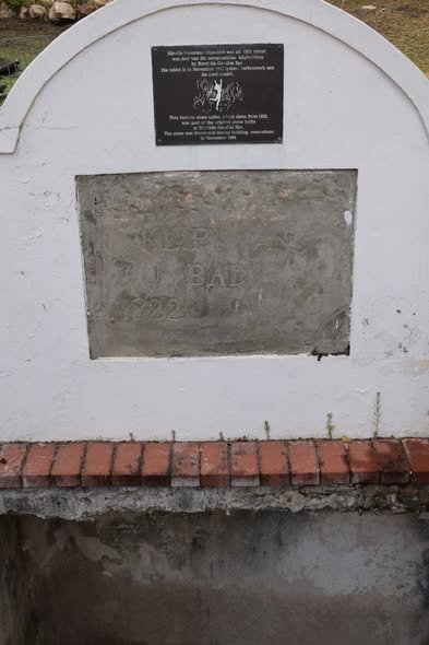
Stone from the original pool
From natural spring to holiday resort
During the nineteenth century, Goudini’s hot mineral water became increasingly well known to colonial visitors. People travelled to natural hot springs believing that bathing in the warm water could relieve various ailments. Accommodation and bathing facilities eventually developed around the spring, turning it into a destination for visitors seeking the benefits of the water.
The spring was not simply a feature of the landscape, however. Its existence depended on the geology beneath the valley, where underground water circulated through fractures in the earth and was heated at depth.
That geological system became dramatically apparent on 29 September 1969, when a powerful earthquake struck the Boland. At Goudini, the effects were visible in the spring itself. Historical accounts describe changes in the water’s temperature, colour and flow. Technical research records that the original hot spring dried up, after which the resort’s hot-water supply was obtained through a deep borehole.
The earthquake had altered the underground pathways through which the water reached the surface. The warm water available to visitors today is therefore not simply the unchanged continuation of the original spring: its supply depends on accessing the underground water system through a borehole.
In 1967, Rondalia acquired the property and helped develop Goudini into a popular family holiday resort. The Afrikaanse Taal- en Kultuurvereniging (ATKV) acquired it in December 1993.
The resort has changed considerably from the natural spring and surrounding farmland of earlier centuries. Yet the name Goudini has survived, carrying with it a possible linguistic connection to honey, a record of Indigenous knowledge encountered by eighteenth-century travellers, and the history of a landscape transformed by colonial settlement, tourism and a powerful earthquake.
Map https://maps.app.goo.gl/6ZcFjteEfrAJPTpJ9