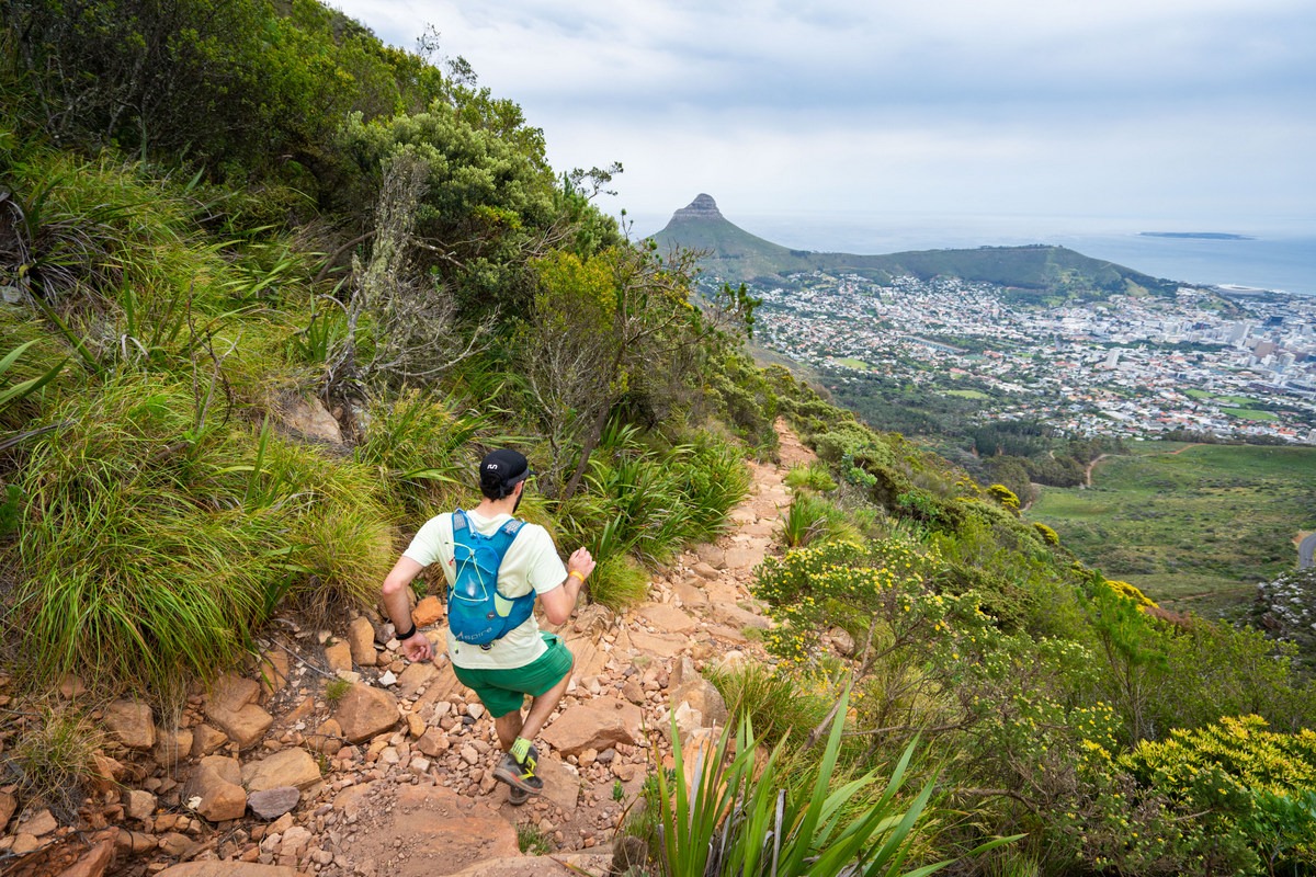
A few running trails around Cape Town
Table Mountain (Tafelberg Road)
Where: Tafelberg Road, Table Mountain, Cape Town
Distance: 9.5 km
Difficulty: Easy to moderate
The out-and-back route follows Tafelberg Road from near the lower cableway station towards Devil’s Peak. The road extends for approximately 4 km, with gentle climbs and descents. Allow about 2 hours 30 minutes for the 9.5 km route.
Dogs are permitted on this route but must be kept on a leash. Parking near the endpoint may allow runners to avoid sections affected by traffic.
Kasteelspoort
Where: Kasteelspoort trailhead, Theresa Avenue, Bakoven, Cape Town
Distance: 4.7 km
Difficulty: Moderate
Kasteelspoort climbs the western slopes of the Twelve Apostles above Camps Bay. The route offers views of the Atlantic coastline and Lion’s Head. A well-known landmark near the top is the rock formation called the Diving Board.
Table Mountain weather can change quickly, with strong winds and sudden cloud cover. Carry warm clothing and check conditions before setting out. The cableway may close in strong winds, although it does not serve as transport from the Kasteelspoort trail itself.
Newlands Forest (Short Circuit)
Where: Newlands, Cape Town
Distance: 8.9 km
Difficulty: Easy to moderate
Newlands Forest is a remnant of the indigenous forest that once covered much of Table Mountain’s eastern slopes. The Short Circuit follows relatively wide paths used by runners and dog walkers. It can be busy at weekends. For a more strenuous route, try Newlands Ravine via Dark Gorge, which has steeper sections and requires more care.
The trees provide shade, and there are occasional views of the city through the forest.
Alphen River Trail
Where: 31 Alphen Drive, Alphen, Cape Town
Distance: 7.7 km
Difficulty: Easy
This mostly flat route runs from Alphen towards Constantia Heights, with gentle inclines along the way. The trail follows a stream and passes through green areas. It is popular with dog walkers, and dogs can accompany runners. Birds include waxbills and bronze mannikins, and squirrels may also be seen. Painted stones are sometimes left along the route to be found and rehidden.
Blokhuiskop Loop
Where: Clovelly Road, Clovelly, Cape Town
Distance: 10 km
Difficulty: Moderate to hard
Starting from Clovelly Road, the route climbs Blokhuiskop through fynbos and wooded sections. There are views across False Bay and towards Kalk Bay harbour. The route also passes the Boomslang Cave, where bats roost, and the White Dome Grotto. The sustained climb makes this a more demanding run.
Upper Woodstock to Rhodes Memorial
Where: Philip Kgosana Drive, Upper Woodstock, Cape Town
Distance: 8.5 km
Difficulty: Moderate
This route follows the slopes of Devil’s Peak from Upper Woodstock towards Rhodes Memorial, with steep ascents and descents. Views include central Cape Town, the harbour, the Atlantic coastline towards Big Bay and the Southern Suburbs. The route ends at Rhodes Memorial, overlooking the University of Cape Town.
The Woodstock side has little shade. Runners may encounter cyclists and hikers along the way.
Karbonkelberg
Where: Bayview Road, Hout Bay, Cape Town
Distance: 9 km
Difficulty: Moderate
The Karbonkelberg route above Hout Bay offers views of the harbour, Chapman’s Peak and Sandy Bay. It forms part of the Table Mountain National Park landscape. Strong winds have shaped sandy, dune-like sections on the mountain’s slopes.
Lion’s Head
Where: Signal Hill area, Cape Town
Distance: 5.3 km
Difficulty: Moderate
This popular loop is used by hikers and runners and can be busy, particularly around sunrise and sunset. The route climbs steeply in places and offers views of Signal Hill, Camps Bay, the city centre, the Twelve Apostles and Table Mountain. Some sections are narrow and require care.
A headlamp is advisable for running in low light. The Signal Hill Spine can be added to extend the route. Dogs may be encountered off-leash in some areas.
East Fort Contour
Where: Chapman’s Peak Drive, Hout Bay
Distance: 6.3 km
Difficulty: Moderate
The route starts near the historic East Fort and continues up steps before joining a wide gravel path. It passes through a riverine forest in a ravine, with perennial water near a weir.
Arrange transport at the endpoint if you do not intend to return the same way. Alternatively, return along Chapman’s Peak Drive, taking care on the road.
Silvermine Dam
Where: Silvermine Dam, Silvermine, Cape Town
Distance: 7.1 km
Difficulty: Moderate
The circular route near Silvermine Dam includes views towards Constantia and Noordhoek and can be walked or run in either direction. The dam is a popular place to cool off after a run, but check current access rules and swimming conditions before entering the water.
Is this your business?Claim it now.
Make sure your information is up to date.Colourdots is an independent Western Cape regional information resource. Learn more about the site here.