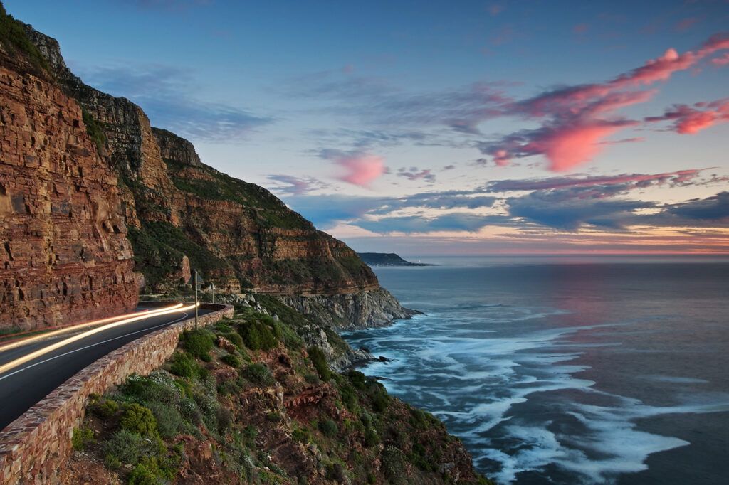
Chapman’s Peak
Chapman’s Peak Drive was conceived by Sir Nicolas Fredrick de Waal as he realised that a road was needed to link Hout Bay and Noordhoek. It is one of Cape Town’s most scenic drives and is a must-see Mother City stop for tourists. Locally known as “Chappies”, the peak was named after John Chapman.
Many believe Chapman was a brave mountaineer or governor, but he was a Captain’s mate on the British ship, Contest. In 1607 it found itself unable to move as there was no wind that day. ( Rare in this part of the world) The skipper of the ship sent his pilot to row ashore in the hopes of finding provisions. The pilot’s name was Chapman.
The bay was later recorded as Chapman’s Chaunce, which means Chapman’s Chance. The name became the official name of the bay on all East India charts.
From the peak, there are majestic views of sheer drops to the sea below with towering mountains above. The 9km route (with its 114 curves) is one of the lesser-hiked peaks on the Table Mountain chain, but it is an absolute paradise for hiking enthusiasts.
Notable lookout points for panoramic views
Chapman’s Peak Viewpoint
Located near the toll plaza, this viewpoint overlooks the winding road and the ocean below. It is a popular stop for photography.
Noordhoek Beach Lookout
At the southern end of the drive, this lookout offers expansive views across Noordhoek Beach, backed by mountains and cliffs.
The Sentinel
Near Hout Bay, The Sentinel provides sweeping views of the bay, turquoise water, and the surrounding mountain range.
The View
This lookout offers uninterrupted coastal views and is a good place to spot marine life, including dolphins, seals, and whales during migration season.
For picnic areas where you can stop and take it all in.you’ll need either a Day Pass or a Picnic Voucher for these stops.Parking: Parking is available right at the picnic areas. Dogs can join but must stay on a leash and under control.
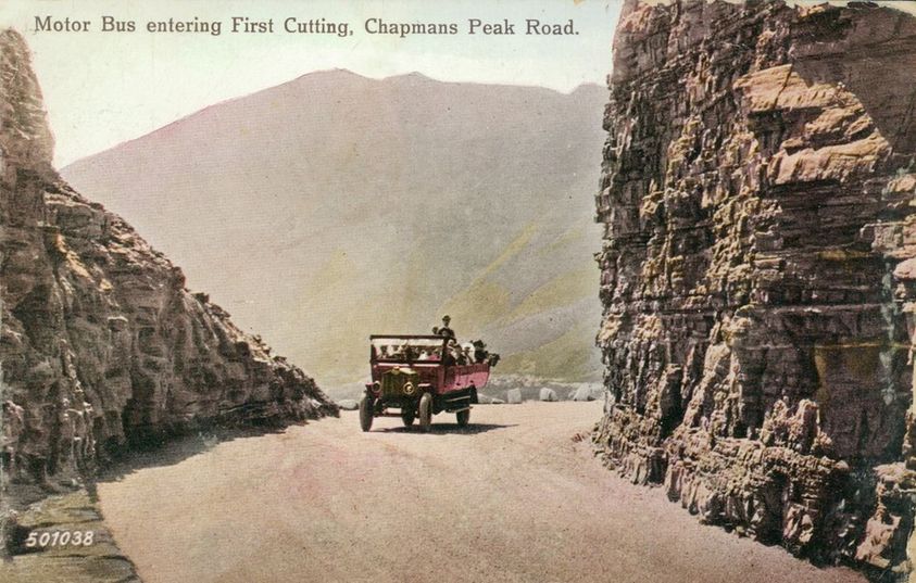
Chapman’s Peak 1920s
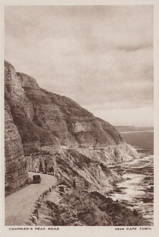
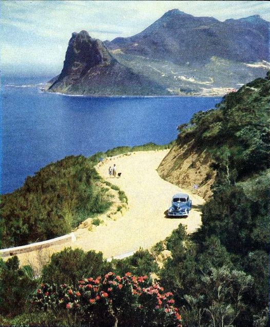 Chapman’s Peak Drive (1940)
The rocky coastline of Chapman’s Peak (593m) is the southerly extension of the Constantiaberg and is a great hiking spot. The road was constructed during the First World War. There is a myth that Italian prisoners of war made Chapman’s Peak Drive. However, during the First World War, the Italians were allies. Local convict labour was used. Construction began on the road in 1915.
Surveyors and workers faced steep, unstable terrain, often requiring them to work on their hands and knees. Despite these difficulties, the project progressed, with the first portion of the road opening in 1919. However, it took seven years to complete, with the road finally opening to traffic in 1922.
The route starts in Hout Bay and hugs the near-vertical face of the mountain. The climb winds steeply up to Chapman’s Point, where you can enjoy stunning views of the sandy beaches down below. The road then reaches lower levels again at Noordhoek. Toll fees are paid at the Toll Plaza, where administration of the drive takes place, and you can also sign up as a Frequent User. Public ablutions are available here. The history of the mountain pass is interesting and dramatic.
Chapman’s Peak is part of the Argus Cycle Race and Two Oceans Marathon. Over 5000 daily users are registered as frequent users, but the service may sometimes be closed due to bad weather or maintenance.
Hiking “Chappies”
This moderately difficult 3-hour hike begins at Chapman’s Peak Parking Area. Proceed to the checkpoint for motorists. The sign points to the beginning of the hike. The route is very well maintained and easy to follow, paved with sandstone rocks most of the way. The slopes even out near the top, turn right and keep going towards Noordhoek along a slowly rising trail.
You will reach the summit of Chapman’s Peak. The scenery is spectacular. Around the first peak, you will see Hout Bay. Further on, you will see great views of Fish Hoek, Noordhoek Beach, and even Gordon’s Bay and Table Mountain on clear days. To the south is Cape Point, and Kommetjie can be seen.
A fairly difficult hike connects Chapman’s Peak and Silvermine. It takes about 6 hours to complete. This is not a circular route, and transport will be needed. To access, drive toward Noordhoek, turn right into Silvermine Road, and then right at the T-junction into Noordhoek Main Road (M6). Pass the Noordhoek Village Centre on your right, and two paddocks on your left before taking a left into Avondrust Circle.
At the second road, Beach Road, turn right and follow the marked signs to the beach parking lot. The route ascends from Noordhoek Beach to Chapman’s Peak, descends to the other side, and then climbs back up again before the final descent down to the Silvermine dam in Silvermine-West. While there are some steep parts of this hike, most of the slopes are gradual. Accompanied children from ages 10 and up are allowed to do this hike, and dogs are also welcome.
Two Oceans Marathon: This road running event held over Easter each year is an ultra marathon that sees 10,000 runners persevering up each curve and bend of Chapman’s Peak Drive
Argus Cycle Tour: 35,000 cyclists take part in this annual biking event, which is one of the largest road biking events in the world. It covers the entire Cape Point Route in March every year, and Chapman’s Peak Drive forms a distinct part of the race
Take a virtual drive over Chappies
Take the drive from the other direction
Some more history of Chapman’s Peak
FAQs about Chapman’s Peak Drive
1. Where is Chapman’s Peak Drive?
Chapman’s Peak Drive runs between Hout Bay and Noordhoek on Cape Town’s Atlantic coast. It’s one of the most scenic coastal drives in South Africa.
2. How do I get there?
From Cape Town, take the M6 via Camps Bay and Hout Bay. The drive starts just beyond Hout Bay Harbour and winds through the cliffs toward Noordhoek.
3. Is there a toll fee?
Yes. Chapman’s Peak is a toll road managed by Entilini Concession. Fees differ for light vehicles, motorbikes, and tour buses. Locals can apply for discounted frequent-user rates.
4. What are the operating hours?
The road is usually open daily from 6:00 to 20:00 in summer and 7:00 to 18:30 in winter, weather permitting. It may close temporarily due to strong winds or rockfall risk.
5. How long is Chapman’s Peak Drive?
The route is about 9 km long with 114 curves, offering spectacular sea and mountain views along the way.
6. Where can I stop to take photos?
There are several viewing points and picnic stops along the drive. The main viewpoints have safe parking bays and lookout areas with railings.
7. Can I walk or cycle along Chapman’s Peak?
Yes. Pedestrians and cyclists are allowed, though cyclists should use caution — the road is narrow and winding. Early mornings are best for safety and light traffic.
8. Are there hiking trails nearby?
Yes. The Chapman’s Peak Trail starts near the toll plaza and leads up to the summit (about 1.5–2 hours round trip). You can also connect to trails in Silvermine Nature Reserve.
9. Is Chapman’s Peak safe to drive?
Yes. The road has a modern rockfall protection system with nets and shelters. Always obey signs and closures. Drive slowly and watch for cyclists and baboons.
10. Can I access Chapman’s Peak Drive at night?
Night access is sometimes restricted for safety. Check the official Chapman’s Peak Drive website for updates before travelling.
11. Are there facilities along the route?
There are public restrooms and picnic areas at certain lookouts. The Day Pass includes short-term access for sightseeing or picnicking.
See some other scenic drives and road trips and browse the complete Western Cape guide