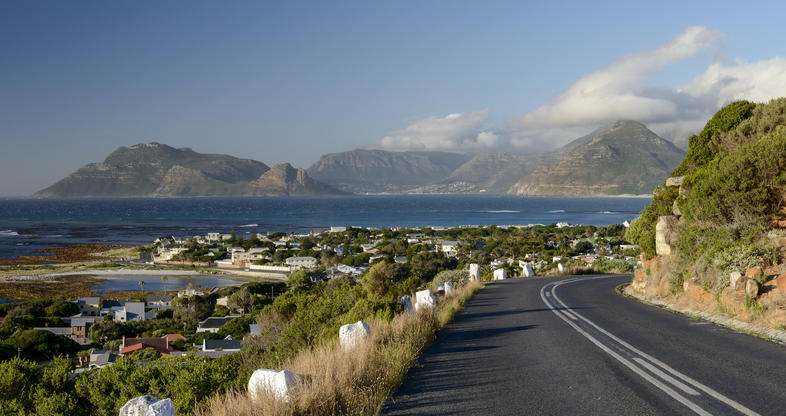
History of Kommetjie
- Province; Western Cape
- Coordinates: 34°08′25″S 18°19′45″E
- Municipality: City of Cape Town
- Area: 2.56 km2
Kommetjie means “small bowl” in Afrikaans, It was established in 1902 when a group of businessmen from Cape Town bought the farm by the same name where they developed a residential suburb. It is situated about midway down the Cape peninsula on the Atlantic Ocean where there are cold currents and great surfing waves. This is an attractive area to live in where residents enjoy great surf, beaches, mountains, and nature.
The Slangkop lighthouse, built on the beach in 1919, is South Africa’s tallest cast-iron lighthouse and it can be seen from Ou Kaapse Weg. The wreck of the Kakapo, which ran aground in 1900, lies off Longbeach.
The postcodes for Kommetjie are 7975 (streets) and 7976 (boxes)
local WEATHER TODAY
see all listings in kommetjie
Things to see and do in Kommetjie:
- -Slangkop lighthouse. You can climb to the top and see the Cape Point nature reserve.
- Slangkop pass
- Ride camels at Imhoff farm
- Horse riding on the beach
- There are great birdwatching opportunities in the area.
Useful Numbers
- Police: Ocean view 021 783 8300
- Traffic department: Fishhook 0217842160
- Fire: Fishhook 021 480 7700
- Water: 0860 103 089
- Electricity: 0860 103 089
- Ambulance: metro emergency services CT 021 508 4500 or 10177
- Post office; 021 783 1763
- Closest hospital; False Bay Hospital 021 782 112
- Pharmacy; 0217830711
- SPCA: 021 700 4140
- Library; 021 783 1848
- Schools: Primary school 021 783 2973
- Ratepayers association:info@kommetjie.org


