- Province: Western Cape
- West Coast
- Coordinates:33°02′S 18°40′E
- Area:3.86 km2
- Municipality: Swartland
Jump to:History of Koringberg |Things to See and Do in Koringberg |Useful Numbers in Koringberg
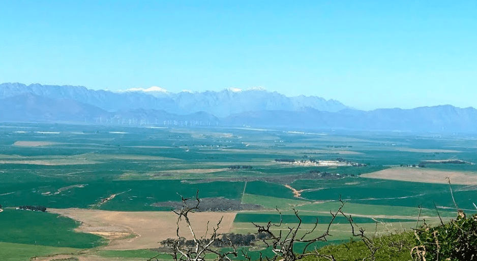
Koringberg is situated in the Swartland region of the Western Cape, north of Moorreesburg and south of Piketberg. The village lies in an agricultural area known for wheat farming and grain production. It is located close to the N7 highway, which connects Cape Town with the northern parts of the province. The surrounding landscape consists of gently rolling hills and wide open farmland typical of the Swartland
History of Koringberg
This peaceful village was originally named after Warren’s Camp, on the farm Brakwater in 1923, after the resident engineer responsible for laying the railway line in the early 19th century. It is essentially a wheat and sheep farming town, but the area also boasts well-known grape farms and a horse stud farm. The name is Afrikaans, and it means ‘wheat mountain.
Horse riding, hiking and mountain biking trails snake through the ruggedly beautiful surroundings and the area has also grown in popularity among paragliders. Misverstand Dam on the Berg River is about 16km from Koringberg and offers canoeing, swimming, fishing and water skiing. One can also take a sunset boat trip down the river with its abundance of birdlife.
Freshwater fishing: see our illustrated guide
local WEATHER TODAY
Browse businesses and places to visit in Koringberg
Things to See and Do in Köringberg
- The Mountain Biking Trail is slowly putting the town on the map.
- Misverstand Dam.
- The largest Hackney horse stud farm in South Africa is on the farm Soutfontein.
- Koringberg Mountain Biking Trail
- 5 kilometre hiking trail to the top of Koringberg
- Neulfonteinkop is a hill where there is an old ship’s cannon, which was used over 100 years ago to communicate to farmers about docked ships in Cape Town so that they could take their produce to town to sell.
- Clay pigeon shooting *
- The Doll Collection*
- Old Blacksmith Workshop (Contact Vleidam farm* 074 217 0027)
Resources
Practical information for the Western Cape, Regulations, permits and helpful tips. See the Colourdots coastal and nature use guide

Useful Numbers in Koringberg
Residents and visitors can find important local contact numbers below, including police, medical services, utilities, and community facilities
-
Emergency Services
- Police: 022 433 2246
- Fire: 022 433 2246/ 022 487 9479
- Ambulance: 10177
-
Medical
- Closest hospital: Piketberg Radie Kottze Hospital 022 913 1175
- Pharmacy; Moreesberg 022 433 1001
-
Municipal & Utilities
- Municipality; 022 487 9400
-
Transport & Roads
- Road Emergencies / SANRAL: 0800 204 204
-
Community & Safety
- Childline-116
- 24 hour Poisons Information Helpline of the Western Cape: 0861 555 777.
- SPCA: Swaartland 022 492 2781
- NSRI 087 094 9774
-
Local Contacts and Community Resources
- Post office; post agency 022 423 8035
- Library: Moreesberg 022 433 1647
-
Local newspapers:
- ” Die Courant”: 022 487 3221
- Swartland Gazette: 022 482 3817
- Tourism 022 433 1072
-
Schools in Koringberg
- Koringberg Primary 022 4828009
- Back to the top ↑
- Towns in the Swartland district include: Chatsworth; Darling; Grotto Bay; Jakkalsfontein; Kalbaskraal; Koringberg; Malmesbury; Moorreesburg; and Riebeek kasteel
Colourdots is an independent regional information resource for the Western Cape.
Learn more about the project HERE