
- Province: Western Cape
- Garden Route
- Coordinates: 34°03′02″S 22°23′51″E
- Area: 1.03 km2
- Municipality – George
Jump to: History of Herolds Bay |Useful Numbers in Herolds Bay
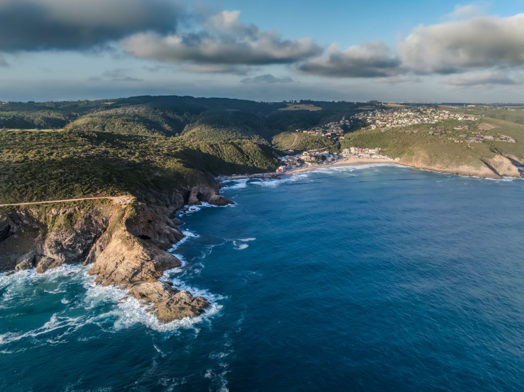
Herolds Bay is a coastal village on the Garden Route in the Western Cape, about 9 km east of George and 10 km west of Victoria Bay. It lies along the N2 and the R102, nestled between the Outeniqua Mountains and the Indian Ocean, making it popular for beach visits, surfing and holiday accommodation. The village forms part of the greater George municipal area and offers easy access to local schools, shops and regional transport routes.
History of Herolds Bay
An NG congregation was established in George in 1812. The minister was Tobias Johannes Herold, who did pioneering work in the area during his ministry. Herolds Bay commemorates his name. The vicar was also a keen angler. The beach resort of Herolds Bay was initially part of the farm Brakfontein, which was the property of Dirk Lamprecht and later of Frans Gericke.
The area was first known as Sandstrand. In 1904, small plots of land were demarcated for tents and wagons. Building materials were delivered on sledges pulled by mules. The first holiday home in Herold’s Bay was built in 1895 for Matilda Howitson from Blanco. Before 1928, only one house was on the west side of Sandstrand Street. The first permanent resident, however, was a survivor of a shipwreck in 1920 who made his home in a beachside cave for eight years.
Behind the village is the Gwaing River valley with access to the indigenous forest with great birdwatching opportunities.
The postal code for Herold’s Bay is 6615, and the license plate prefix is CAW

Watercolour by Alice Negus
Vintage picture Saartjie Klipkop
Things to see and do in Herolds Bay
- The beach is in a rocky cove which faces roughly north, which means it gets sun in the morning and it is protected from the south-easterly wind that often picks up in the afternoon
- The Heritage Trail is a 12.6-kilometre circular route that follows a path through indigenous forest, along the Gwaing River, and returns along the coastal cliffs.
- Dolphins are regularly seen from the cliff sections, and Whales can be seen from May to November.
- The Oubaai Golf Estate borders the village. It was South Africa’s first Ernie Els signature course. The 18-hole layout runs between the Gwaing River valley and the Indian Ocean across dramatic coastal terrain
- The Herolds Bay Loop Trail starts and ends near Herolds Bay, with parking at the trailhead. The route passes through coastal fynbos and inland terrain, with views towards the ocean, hills and coves. It is a moderately difficult trail with some elevation changes and steeper sections, and is best suited to hikers with a reasonable level of fitness. The route is marked.
Resources
Practical information for the Western Cape, Regulations, permits and helpful tips. See the Colourdots coastal and nature use guide
Local WEATHER TODAY
Browse businesses and places to visit in Herolds Bay
<
Useful Numbers in Herolds Bay
Residents and visitors can find important local contact numbers below, including police, medical services, utilities, and community facilities. The closest main town is George.
-
Emergency Services
- Police: 044 803 4400
- Fire: George Brandweer and Nooddienste-044 801 6311
- Ambulance: 10177
-
Medical
- Closest hospital: George Hospital-ER- 044 874 5122
- Pharmacy; Pacaltsdorp Pharmacy-044 878 1707
-
Municipal & Utilities
- Municipality: 044 801 9111
- Water: 044 801 9266/ 62
- Electricity:044 874 3917
-
Transport & Roads
- Traffic department:044 878 2400
-
Community & Safety
- SPCA: Garden Route – 044 693 0824
- NSRI: 087 094 9774
-
Local Contacts and Community Resources
- Post office; Pascaltdorp: 044 878 2520
- Library:044 803 9340
- Tourism – 044 801 9103
- Colourdots is an independent regional information resource for the Western Cape.
Learn more about the project HERE