
- Province: Western Cape
- Coordinates 33°52′32″S 18°32′27″E
- Municipality: City of Cape Town
- Area: 4.01 km2
Jump to:
History of Edgemead |Things to See and Do in Edgemead |Useful Numbers in Edgemead
Edgemead is a residential suburb of Cape Town in the Western Cape, about 12 km north of the city centre. It lies between Bothasig, Monte Vista and Plattekloof and is accessible via the N1 highway and the Bosmansdam Road corridor. The suburb forms part of the City of Cape Town municipality and is close to Canal Walk, Century City and major transport routes.
History of Edgemead
Edgemead was established in 1972 as a planned residential suburb by Garden Cities, an organisation influenced by the garden-city movement that began in Britain in the late 19th century. The idea was to create residential communities with well-planned housing, open spaces, schools, churches and recreational facilities rather than simply allowing houses to spread without an overall plan.
The development began with the acquisition of 263 hectares of the farm Plattekloof in 1967, at the foot of the Tygerberg Hills. Additional land was acquired as the suburb expanded, and Edgemead eventually covered more than 340 hectares.
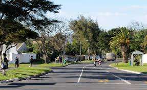
The physical layout was carefully planned. Curved roads, cul-de-sacs, pedestrian paths, parks and informal open spaces were incorporated into the design, giving the suburb a village-like character. The first Edgemead house was sold in 1972 for R14,945.
Garden Cities also placed considerable emphasis on the appearance of the new homes and their surroundings. Houses were designed using good-quality materials and were planned to allow for privacy, gardens and future extensions. Walls and other features were used in places to screen washing lines, refuse bins and other less attractive household features from the street. These design principles, together with the trees and open spaces that have matured over the years, have contributed to Edgemead’s established suburban appearance.
The suburb was planned with community facilities within easy reach of residents. Schools, pre-schools, churches, sports facilities, parks and greenbelts were incorporated into or established around the residential development. The layout made it possible for many of these facilities to be reached without travelling far from home.
Some of Edgemead’s streets are named after notable South African artists and architects, including Anton Anrieth, Thomas Bowler and Louis Thibault. Their names form part of the suburb’s connection with Cape Town’s artistic and architectural history.
Edgemead has also developed a strong community life around its schools, sports clubs, churches and residents’ organisations. The Edgemead Residents’ Association represents local interests and has played a role in maintaining the character of the suburb.
Today, Edgemead remains recognisable as a planned Garden Cities development. Its curved streets, established gardens, pedestrian routes, parks and community facilities reflect the principles used when the suburb was laid out more than fifty years ago.
The suburb is located in Ward 5, together with the suburb of Bothasig.
The postal codes for Edgemead are 7441 (streets) and 7407 (boxes)
Transport
Edgemead is served by Golden Arrow Bus Services and minibus taxis. See linked pages for details. Other options for getting around the Western Cape.
local WEATHER TODAY
Browse businesses and places to visit in Edgemead
Things to See and Do in Edgemead
- Plattekloof Heritage Site.
- The Bend Park Outdoor Gym, The Bend
- Skate park opposite the community hall
Resources
For permits, regulations and other practical outdoor information relevant to Edgemead, see the Colourdots coastal and nature use guide

Useful Numbers in Edgemead
Residents and visitors can find important local contact numbers below, including police, medical services, utilities, and community facilities in and around Edgemead
-
Emergency Services
- Fire: Milnerton fire dept; 021 400 6949
- Ambulance: 111 or Rescue Medix 074 173 7283
- Police: 021 559 9400
-
Medical
- Milnerton Mediclinic – 086 122 4555
- Clicks pharmacy- 21 558 1047
-
Municipal & Utilities
- Water: 021 4444 863 Milnerton Municipal Building Royal Ascot way Milnerton
- Electricity: 0214444863 0860 103 089
- Transport & Roads
- Road Emergencies / SANRAL: 0800 204 204
- Traffic department: Milnerton 021 550 1312
- Community & Safety
- Childline South Africa: 116
- Poison Information Centre: 0861 555 777
- Snake/Scorpion/Spider Bite Hotline: 021 931 6129
- SPCA: Cape Town Grassy Park 021 700 4140
- Local Contacts and Community Resources
- Community Hall Hire. 021 590-1434
- Library: 021 444 7352
- Edgemead Neighbourhood Watch: enw@edgemead.co.za
- Schools in Edgemead
- Edgemead Primary: 0215581007
- Edgemead High; 021 558 1132
FAQs
1. Where is Edgemead located?
It is a northern suburb of Cape Town, situated between Goodwood and Bothasig, about 20 minutes from the city centre.
2. What type of suburb is it?
It is a quiet, residential garden suburb known for its tree-lined streets, schools, and strong sense of community.
3. Are there shops and restaurants in Edgemead?
Yes . A Village Centre offers supermarkets, takeaways, restaurants, and local services.
4. What schools are in the area?
The suburb has several schools, including a high school and a primary school, both of which are well-regarded.
5. Is Edgemead safe?
It’s considered one of Cape Town’s well-managed, family-oriented suburbs, with active neighbourhood watch groups and community policing.
6. How do you get to Edgemead?
Access is via the N1 or Plattekloof Road, with easy routes to Century City, Goodwood, and the city centre.
7. Are there parks or outdoor areas?
Yes, there are several parks, play areas, and sports fields maintained by the local council.
8. What public transport options are available?
Golden Arrow buses connect residents to the CBD and neighbouring suburbs.
9. Is Edgemead close to major shopping areas?
Yes it’s a short drive from Canal Walk, N1 City Mall, and Plattekloof Village.
10. Are there community events?
Yes, there are local markets, fairs, and charity events at the community hall and sports grounds.
- Colourdots is an independent regional information resource for the Western Cape.
Learn more about the project HERE