Jump to: History of Claremont |Things to See & Do in Claremont |Useful Numbers in Claremont
- Province: Western Cape
- Coordinates; 33°58′50″S 18°27′55″E
- Area: 5.21 km2
- Municipality: City of Cape Town
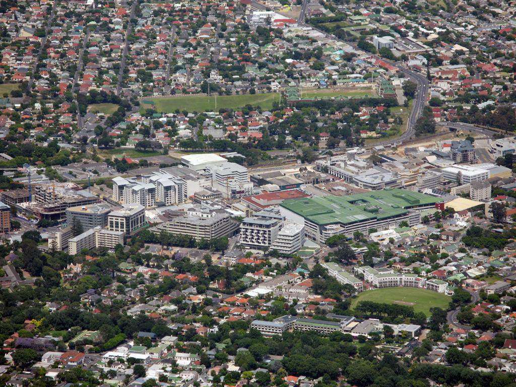
Claremont lies in the southern suburbs of Cape Town, bordered by Rondebosch, Newlands, and Kenilworth. The suburb is part of the City of Cape Town metropolitan area and serves as a commercial and residential hub. Key access routes include Main Road (M4) and the M3 highway, connecting Claremont to central Cape Town and nearby suburbs. There are several shopping centres and schools in Claremont.
History of Claremont
Before the Dutch colonists arrived in 1652, the Cape Peninsula was largely inhabited by the Khoisan people, who were nomadic. The Dutch established an outpost in Table Bay, and after 165,7 they ventured further south to establish farms. Two of these farms, Louwvliet and Questenburg, were in the areas now called Claremont and Newlands. The area remained agricultural for at least 150 years. Some of the farms in the area produced grapes, others, grain and vegetables.
In the 1800s, British settlers bought up properties here, and the village began to grow. The area was named after the Claremont house estate in the area.
One of the most influential families in the early development of the area was the Arderne family, who began planting the gardens that would later become Arderne Gardens in 1845. This garden remains a Provincial Heritage Site today.
A few cottages were built in lower Claremont for working-class people, referred to by the government of the time as “non-Europeans. The area grew more when the railway line was extended to Wynberg in 1864. By 1883, the area was incorporated into the Liesbeek municipality, which included Upper Claremont, Rondebosch, Wynberg, Mowbray and Newlands.
In 1883, Lower and Upper Claremont were incorporated into the Liesbeeck municipality. By 1890, the area had grown enough to be granted separate municipal status. However, in 1913, Claremont was officially absorbed into the Cape Town municipality.
The end of the Anglo-Boer War saw a housing boom when there was a further subdivision of the larger estates during the 1900s.
After the advent of the British takeover in 1814, the area became more residential than agricultural.
As the suburb grew, the main road developed into a commercial hub. Claremont was granted municipal status and became a suburb of Cape Town in 1913.
However, the suburb was identified as a “black spot” in 1953 due to African families squatting in “informal housing” in the suburb. A visiting official reported that the government had to ”get rid” of black and coloured residents. The Group Areas Act of 1913 sealed their fate, and blacks were no longer allowed to own or rent land outside their designated areas, which were in locations on the outskirts of the city. In 1969, Lower Claremont was declared a white area. All owners of colour had to sell to white people.
After this rezoning, it was renamed Harfield Village.
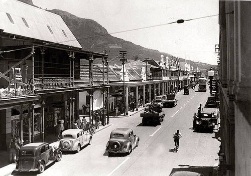
Vintage photo of Main Road
Post 1994, Coloured people started moving back into the area. It is now cosmopolitan with people of all colours and cultures making their homes and conducting business locally
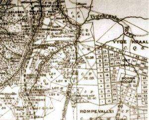
Keurboom Estate
The suburb was home to several notable people. Sir John Herschel, the astronomer, lived there from 1834 to 1838. He mapped the southern skies at his home, Feldhausen. John Molteno, who became the first Prime Minister of the Cape Colony, also lived in Claremont after purchasing part of the Claremont House Estate.
Transport
Claremont is served by Metrorail, Golden Arrow Bus Services, and minibus taxis. See linked pages for details. Other options for getting around the Western Cape.
Things to See & Do in Claremont
- Choo Choo Park on Belvedere Road is a safe and enclosed park. There are some well-maintained jungle gyms and swings. The “choo-choo is popular with young visitors. : 07h00-19h00 (April -Sept) 07h00-20h30 (Oct-March)
- The Herschel Obelisk is where John, the son of Sir William Herschel (who discovered the planet Uranus), used his 20-foot telescope and mapped the southern skies from 1834 to 1838. This added more than 3800 celestial bodies and objects to the map. Contact The Grove Primary School for access. Tel: 021 674 2077
- Ardene gardens
- The Josephine mill
- Thrift shops in Claremont
- Second-hand bookshops
Resources
For permits, fishing rules, shell collecting regulations and other practical outdoor information, see the Colourdots coastal and nature use guide
Back to the top
WEATHER IN CLAREMONT TODAY
Browse businesses and places to visit in Claremont

Useful Numbers in Claremont
Residents and visitors can find important local contact numbers below, including police, medical services, utilities, and community facilities
-
Emergency Services
- Police: 021 657 2250
- Fire: Wynberg-021 444 9623
- Ambulance:10177
-
Medical
- Claremont private hospital-21 670 4300
- Life Kingsbury hospital- ER 0216704180
- Clinic-021 444 6426
- Pharmacy;Synergy pharmacy-021 671 7100
-
Municipal & Utilities
- Municipality City Of Cape Town 0860 103 089
- Water:0860 103 089
- Electricity:0860 103 089
-
Transport & Roads
- Traffic Department: Hillstar Traffic Department
- Road Emergencies / SANRAL: 0800 204 204
-
Community & Safety
- NSRI 087 094 9774
- 24-hour Poisons Information Helpline of the Western Cape: 0861 555 777.
- Childline South Africa: 116
- SPCA: Cape of Good Hope SPCA-021 700 4140
-
Local Contacts and Community Resources
- Post office;021 674 3800
- Claremont Civic Centre: 021 444 6948
- Library-021 673 2060
-
Schools in Claremont
- Claremont High School-021 671 0645
- Claremont Primary School-021 674 2126
- Herschel Girls School-021 670 7500
- Rosmead Central Primary School-021 671 6502
- Livingstone High School-021 671 5986
- Western Province Preparatory School-021 761 8074
- Garfield Pre-primary-021 674 2354
- Greenfield Girls’ Primary School-021 797 0554
- Bairnsleigh Pre-Primary School-021 671 3390
- Herschel Secondary School-021 670 7500
- Herschel Girls Preparatory School-021 670 7520
- Batavia School-021 671 5110
Back to the top
Adjacent suburbs are Diep River; Harfield village; Heathfield; Kenilworth; Kenwyn, Newlands; Plumstead ; Rondebosch; and Wynberg
- Colourdots is an independent regional information resource for the Western Cape.
Learn more about the project HERE