- Province: Western Cape
- Coordinates: 34.1194° S, 18.9085° E
- Area: 1.98 km2
- Municipality; City of Cape Town
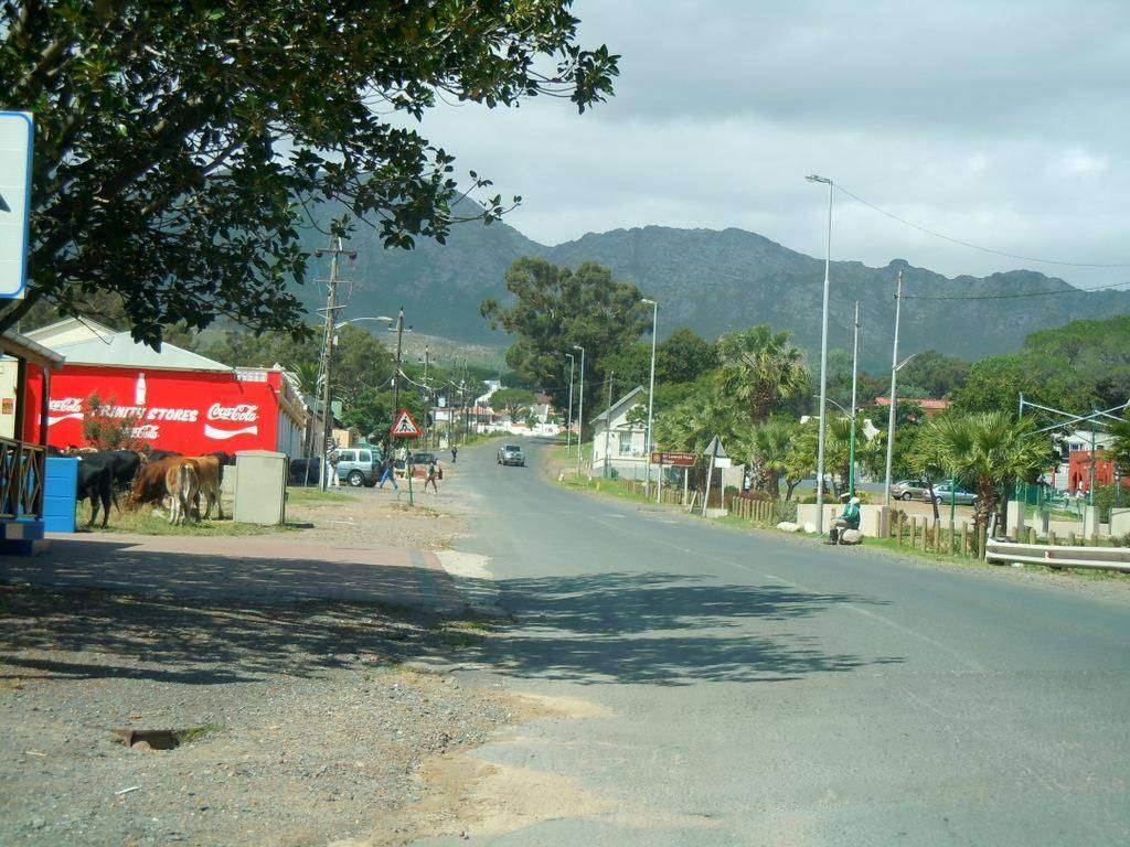
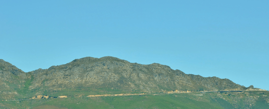
Sir Lowry’s Pass Village is situated in the Helderberg region of Cape Town in the Western Cape. It lies at the foot of the historic Sir Lowry’s Pass, just above Somerset West and alongside the N2 highway. The village sits on the lower slopes of the Hottentots Holland Mountains, forming a gateway between Cape Town and the Overberg region.
History of Sir lowry’s pass Village
Sir Lowry’s Pass village and the Flower Trade
Sir Lowry’s Pass village was named after Sir Galbraith Lowry Cole, Governor of the Cape in 1828.
The building of the mountain pass
The mountain was forbidding and difficult to climb to reach the interior. Ox wagons, along with oxen, were often smashed as they overbalanced or lost footing while attempting the climb.
By the mid-1800s, it became imperative to improve the roads. There had been attempts to improve the Kloof crossing, which were abandoned due to cost. It became obvious that a new road with a less steep gradient should be built. Plans were made, and tenders were submitted. Sir Lowry won the tender, and the new pass officially opened in July 1830. It remained unchanged until some reconstruction in 1958. Further upgrades were done in 1984.
A tollgate was initially located at the top of the pass at what was called “Cloevermaaker Huys”. Tolls were collected to help offset the cost of building the pass.
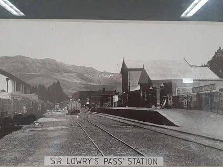 Vintage picture from Saartjie Klipkop
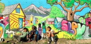
Look out for murals and street art created by a community project
The postcode for Sir Lowry’s Pass Village is 7130, and the license plate prefix is CFM
WEATHER IN SIR LOWRY’S PASS TODAY
Browse businesses and places to visit in sir lowrys pASS VILLAGE

Useful Numbers in sir lowry’s pass Village
Residents and visitors can find important local contact numbers below, including police, medical services, utilities, and community facilities
-
Emergency Services
- Police: 021 858 1710
- Fire: Strand Fire Station-021 444 7600
- Ambulance: 10177
-
Medical
- Closest hospital: Sir Lowry’s Pass Community Health Centre – 021 858 1493
- Pharmacy; Clicks Pharmacy – Vergelegen – 021 851 5936
-
Municipal & Utilities
- Water: 0860 103 089
- Electricity:0860 103 089
-
Transport and roads
- Traffic department: 021 400 3915
- Community & Safety
- NSRI 087 094 9774
- SPCA: Animal Welfare Society Helderberg – 021 856 0597
-
Local Contacts and Community Resources
- Post office; Somerset West Post Office -021 851 7053
- Library:021 858 1139
-
Schools in Sir Lowry’s Pass village
- Schools: Sir Lowry’s Pass Primary School – 021 858 1282
Other towns and suburbs in the Helderberg district include Gordon’s Bay, Macassar, Nomzamo, Paarl; and Somerset West and Strand
- Colourdots is an independent regional information resource for the Western Cape.
Learn more about the project HERE