- Province: Western Cape
- Winelands
- Coordinates:33°48′S 19°53′E
- Area:23.5 km2
- Municipality: Langeberg
Robertson is a town in the Breede River Valley of the Western Cape, South Africa. It lies about 150 km east of Cape Town along Route 62 and forms part of the Langeberg Local Municipality. The town is situated on the banks of the Breede River and is surrounded by vineyards, orchards and mountain ranges, including the Langeberg Mountains. Robertson serves as an agricultural, wine-producing and tourism centre within the valley and is accessible via the R60 and R62 routes. Robertson functions as both a working agricultural centre and a well-established wine tourism destination within the Langeberg region.
History of Robertson
Founding of the town
This town was founded in 1853 and named after a Scottish, Dutch Reformed minister, Dr William Robertson. It is in a fertile valley where the economy revolved around farming and wagon building. There were many wheelwrights, blacksmiths, carpenters, upholsterers, and professional transport riders based in the town. The wagon-building industry became redundant when the transport of goods could be done using the railway infrastructure.
Robertson also had a thriving ostrich industry. The collapse of the ostrich-feather industry at the whim of fashion in 1915 ruined many farmers, but its transition to a wine-farming region has ensured prosperity.
Agriculture and the economy
Successful racehorse stud farms were established sometime later, but agriculture is the mainstay of the town’s economy today. It is one of the most successful Wineland towns and is one of the largest in South Africa. The area is known as the Muscadel and Brandy capital of South Africa
Irrigation in the town of Robertson
The area has relatively low rainfall, and a river irrigation scheme brought water to farms by way of furrows and canals. Subsequently, farms became more productive.
In the 1720s, migrant farmers were attracted to this area for sheep and cattle grazing. By the early 1800s, many of them had settled permanently in the area. They bought land directly from the government.
By 1852, it became necessary for a town to be established. Farmland was bought from Johannes Van Zijl, and plots were made available at forty pounds each.
Robertson during the Anglo-Boer War
The laying of the cornerstone of the Dutch Reformed Church in 1853 in the middle of the town is considered the birthday of the town. Soon thereafter, schools and stores were built.
A British garrison was stationed here during the Second Anglo-Boer War, and the First World War saw many local men leave, never to return.
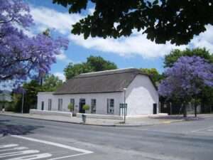
The town today is beautiful, with jacaranda tree-lined streets and immaculately preserved buildings. It is known for its gardens and its roses in particular.
Robertson is the “capital” and business centre of the Breede River Wine Valley, also known as the Valley of Wine and Roses. It’s a safe, country town with Victorian buildings, jacaranda-lined streets, and beautiful gardens. There are over 50 wine cellars in the area.
The license plate prefix in Robertson is CCD, and the postcode is 6705
local WEATHER TODAY
Browse businesses and places to visit in ROBERTSON
Things to see and do in Robertson
- Soekershof. One 5-circuit classical labyrinth and one 3-circuit labyrinth of contemporary design. Plus the world’s largest hedge maze 023 626 4134
- Look out for the Wacky Wine Weekend in June
- The De Jong Typo press, established in 1875, is one of the oldest printing works in the country
- Agricultural show robertsonshow@bigpond.com
- Lenteskou/Spring show 023 626 2512
- Arangieskop is a 2-day hike in the Dassieshoek Nature Reserve, outside Robertson
- Dassieshoek pass
- Sondagsnek
- Die Bloubanke/Eilandia pass
- Hands-on harvest
- Park Run Every Saturday at 8 am at Robertson Winery
- Every Saturday – NCCR Steam train trip Departure: Robertson Railway Station 11.00 am
- Robertson Transport Services
Resources
Practical information for the Western Cape, Regulations, permits and helpful tips. See the Colourdots coastal and nature use guide

Useful Numbers
Residents and visitors can find important local contact numbers below, including police, medical services, utilities, and community facilities
-
Emergency Services
- Police: 023 626 8340 10111
- Fire: 023 6261375 /082 7707964
- Ambulance: 10177
-
Medical
- Closest hospitals;
- State Hospital 023 6268500
- Carewell Private Hospital 028 050 2266
- Pharmacy; 023 6264336
-
Municipal & Utilities
- Municipality 023 615 8000 52 Church Street
- Transport & Roads
- Traffic department: 023 626 8251
-
Community & Safety
- NSRI 087 094 9774
- Poison helpline: 021 931 6129
- SPCA: Winelands branch: 023 615 2241
-
Local Contacts and Community Resources in Robertson
- Home affairs: 021 468 4506 / 4508
- Tourism Office-(Tel) 023 626 4437
- Post office; 023 626 1001
- Library: 023 626 8205
- Callie De Wet sports field 626 8200
- Nkqubela sports fields: 023 626 8200
- Van Zyl Street sports fields: 023 626 8200
- Nkqubela Hall:023 626 8200
- Town hall: 023 626 8200
- Civic centre: 023 626 8200
-
Museums;
- Museum 50 Paul Kruger St 023 626 3681
Commando building Kerk st - Bedehuis Betanie 023 626 5345
-
Schools in Robertson
- Laerskool Robertson 023 626 3060
- Robertson High 023 626 3159
- Vergesig primary 023 626 3839
- Langeberg secondary023 626 3579
- Nkquebela primary 023 626 1543
- Colourdots is an independent regional information resource for the Western Cape.
Learn more about the project HERE