- Province: Western Cape
- Coordinates:34°10′00″S “18°52′00″E
- Area: 9.67 km2
- Helderberg
- Municipality; City of Cape Town
Jump to: History of Gordon’s Bay |Things to See and Do in Gordon’s Bay |Useful Numbers in Gordon’s Bay
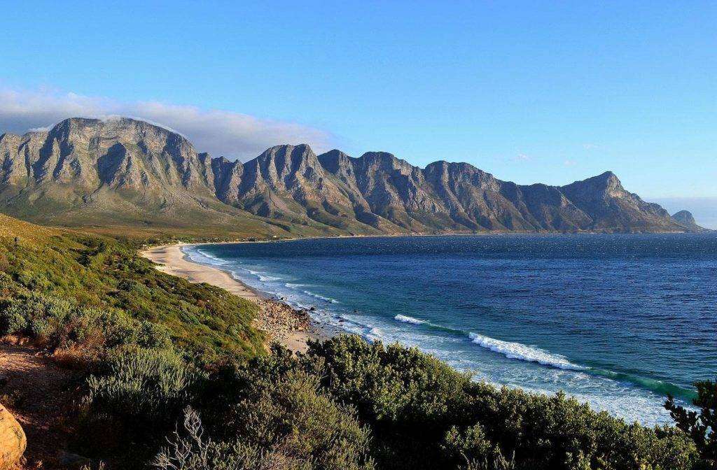
Gordon’s Bay lies on the north-eastern edge of False Bay in the Helderberg area of the City of Cape Town, about 45 km from central Cape Town and just beyond Strand. It sits between the lower slopes of the Hottentots Holland Mountains and the coastline, with the R44 (Clarence Drive) beginning here and running along the scenic coastal route toward Rooi-Els and Pringle Bay. The N2 highway provides direct access inland via Somerset West.
History of Gordon’s Bay
Early days
Gordon’s Bay is a suburb in the Helderberg area (formerly Hottentots Holland) of Cape Town. It was originally called Visser’s Bay. Around 1673, it was called De Vishoek or Combuys in 1676. Here was a place where there was fresh water and game to be found.
Origin of the name
Long before it became Gordon’s Bay, the cove was mapped as Vischhoeks Baay in 1673 due to its rich fishing waters and was once also referred to as Fishhoek, an older name still visible on the wall of the Gordon’s Bay Post Office. The current name was given in 1773 by Robert Jacob Gordon, a Dutch East India Company officer of Scottish origin who explored the region. He documented his travels and learned to speak both Hottentot and Xhosa. Gordon went on many expeditions and kept accurate journals, and is credited with naming the Orange River and introducing Merino sheep to South Africa.
The Old Harbour, originally used by local fishermen, was formally developed in 1937 when a gold coin was placed under the first brick for luck, while the area’s naval heritage grew through the SATS General Botha naval training base. This legacy is reflected in the iconic “GB” letters and anchor on the mountainside, built in 1949 by naval cadets to commemorate the South African Naval College. The historic Old Village also preserves much of its original character, including streets lined with milkwood trees that are centuries old, a 1903 police station, and a 1939 post office that is still used today..
World War II Coastal Defences
During World War II, German raiders and submarines operated in the waters around the Cape, threatening merchant shipping and laying minefields near the coast. To protect the important shipping route around Cape Town, a network of coastal defence batteries was established around False Bay and the peninsula.
Heavy 9.2-inch guns were positioned at places including Simon’s Town, Robben Island, Llandudno and Fort Wynyard near the present-day V&A Waterfront. Defensive positions were also established near Gordon’s Bay and the Steenbras area to help protect the coastline and important infrastructure during the war.
The license plate prefix for Gordon’s Bay is CEY. The postal code is77140(street) and 7151 (boxes)
Transport
Gordon’s Bay is served by Golden Arrow Bus Services, and minibus taxis. See linked pages for details. Other options for getting around the Western Cape.
WEATHER IN GORDON’S BAY TODAY
Browse businesses and places to visit in GORDON’S BAY
Things to See and Do in Gordon’s Bay
- Bikini Beach has Blue Flag status.
- Steenbras mountain pass
Resources
Practical information for the Western Cape, Regulations, permits and helpful tips. See the Colourdots coastal and nature use guide

Useful Numbers in Gordon’s Bay
Residents and visitors can find important local contact numbers below, including police, medical services, utilities, and community facilities
-
Emergency Services
- Police: 021 856 2677
- Fire: Strand-021 444 7600
- Ambulance:10177
-
Medical
- Closest hospital; Mediclinic Strand-021 854 7663
- Gordon’s Bay Clinic-021 444 9315
- Pharmacy; BAY-KEM PHARMACY-021 856 1388
-
Municipal & Utilities
- Water:0860 103 089
- Electricity:0860 103 089
-
Transport & Roads
- Traffic department: 021 856 8570
- Community & Safety
- NSRI 087 094 9774
- SPCA: Animal Welfare Society Helderberg-021 856 0597
-
Local Contacts and Community Resources in
- Library:021 400 6371
- Post office;021 856 1283
- Residents Association;082 384 9699
- Museum: Lwandle Migrant Labour Museum-021 845 6119
-
Schools in Gordon’s Bay
- Gordon’s Bay Primary School-021 856 1288
- Somerstrand College-021 856 2644
- Find a comprehensive list of Cape Town Emergency numbers HERE
- The City of Cape Town Public Emergency Communication Centre is available 24/7 For all life or property-threatening emergencies. Call 021 480 7700 from any phone or 107 from a landline or report online at https://bit.ly/3o4Ji3K
Other towns and suburbs in the Helderberg district include: Macassar, Nomzamo; Paarl, Sir Lowry’s Pass village, and Somerset West and Strand
- Colourdots is an independent regional information resource for the Western Cape.
Learn more about the project HERE