- Province: Western Cape
- Coordinates: 33.92°S 18.43°E
- Area: 2.34 km2
- Municipality; City of Cape Town
Jump to: History of Foreshore |Things to See and Do in Foreshore |Useful Numbers in Foreshore
Foreshore is a central district in Cape Town, Western Cape, located between the Cape Town CBD and the V&A Waterfront. It is bordered by the city centre to the north, the Atlantic Ocean to the west, and major roads, including the N1 and the Foreshore Freeway. The area includes transport hubs, offices, residential complexes, and cultural landmarks, forming a key part of Cape Town’s central urban landscape.
History of Foreshore
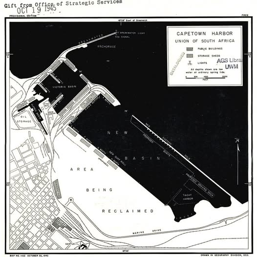
Until the 1940s, the Foreshore was underwater. Salt River and Paarden Island were part of a large tidal estuary where the Liesbeek and Black Rivers met naturally. By the early 20th century, most of this land was reclaimed, and by the 1960s, the rivers were canalised, with the modern confluence near Observatory completed around 1968.
The Dutch firm Hollandse Aanneming Maatschappij was contracted in 1937 to do the work of draining and reclaiming, and 194 acres were reclaimed on the shore of Table Bay.
The job was supposed to be completed in 1941, but due to the war, the deadline was extended to 1945. Before the reclamation, the shoreline was at the present railway station. The row of palm trees that still stands marked the original waterfront.
The work officially began in 1935 with an opening ceremony, including General J.B. M. Hertzog, the Prime Minister at the time.
See a virtual demo of the construction of the Foreshore
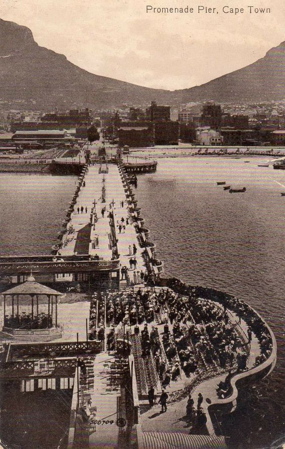
Vintage picture of the old pier that was demolished before the reclamation.
The area was administered by the Foreshore Board, which was created in 1950, and it did not fall under the management of Cape Town City. However, it is now included in the Cape Town municipality. The Foreshore project was probably the most ambitious reclamation scheme undertaken anywhere in the world at the time.
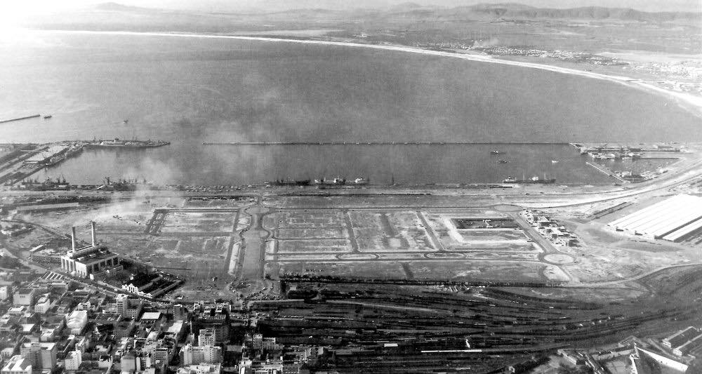
Foreshore 1950s
The postcode on the Foreshore is 8001
Transport
The Foreshore is served by MyCiTi Bus, Golden Arrow Bus Services, and minibus taxis. See linked pages for details. Other options for getting around the Western Cape.
Things to See and Do in Foreshore
- The Cape Town Railway Station,
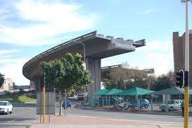
- -The Cape Town Civic Centre,
- -Artscape Theatre Centre,
- -Cape Town International Convention Centre
- -Paul Sauer Building,
- Culemborg
Resources
Practical information for the Western Cape: regulations, permits, and helpful tips. See the Colourdots coastal and nature use guide
Local WEATHER today
all listings on the foreshore

Useful Numbers in Foreshore
-
Emergency Services
- Police: Table Bay Harbour Police Station- 021 403 1000
- Fire: Central Fire Station & Sentrale Brandweerstasie-021 444 8963
- Ambulance: 10177
-
Medical
- Closest hospital/clinic;Netcare Christiaan Barnard Memorial Hospital-021 441 0000
- Pharmacy-021 441 0344
-
Municipal & Utilities
- Water: 0860 103 089
- Electricity: 0860 103 089
-
Transport & Roads
- Traffic Department: Gallows Hill Traffic Department-0860 103 089
-
Community & Safety
- SPCA: 021 700 4140
- NSRI 087 094 9774
-
Local Contacts and Community Resources
- Post office; Cape Town General Post Office, Grand Central-021 464 1707
- Museums;
- Castle of Good Hope-021 787 1260
- Slave Museum Cape Town- 021 467 7229
- Zeitz Museum of Contemporary Art Africa-087 350 4777
- Iziko Slave Lodge-021 467 7229
-
Schools on the Foreshore
- Curro Foreshore-021 834 1977
- EC Cape Town English Language School-021 422 4111
- Find a comprehensive list of Cape Town Emergency Numbers HERE
- Colourdots is an independent regional information resource for the Western Cape.
Learn more about the project HERE