- Province: Western Cape
- Coordinates: 33.9540° S, 18.4754° E
- Area: 1.10 km2
- Municipality: City Of Cape Town
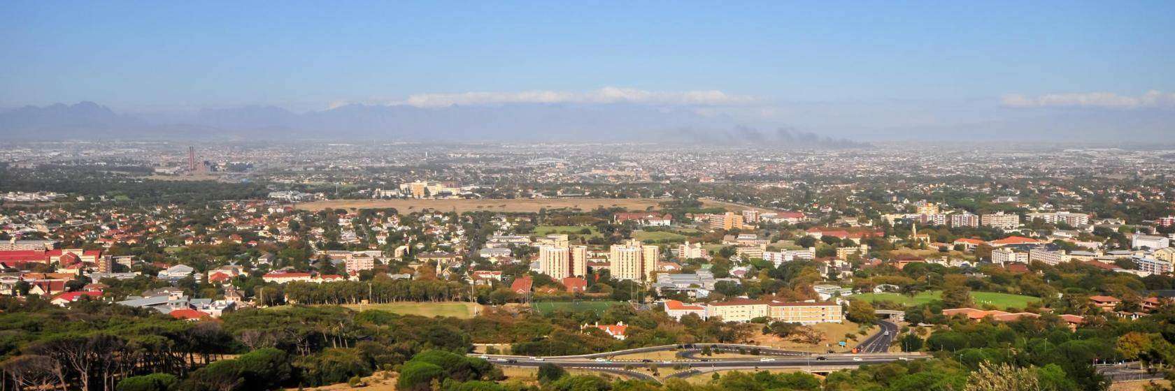
Rosebank is a suburb of Cape Town in the Western Cape, located in the Southern Suburbs. It lies east of Rondebosch, south of Mowbray, and west of Newlands. Rosebank is situated along the Liesbeek River. and is characterised by residential streets and proximity to major transport routes. The suburb is popular with students due to its short distance to the University of Cape Town.
History of Rosebank
This suburb was established where the farm Vredenberg lay along the banks of the Liesbeek River. Rosebank grew when the railway line from Salt River reached the area in 1864. The original farmhouse still stands today. There are many beautifully restored Victorian homes in the suburb.
The postcode for Rosebank is 7700
Transport
Rosebank is served by Metrorail Golden Arrow Bus Services, and minibus taxis. See linked pages for details. Other options for getting around the Western Cape.
Resources
Practical information for the Western Cape, Regulations, permits and helpful tips. See the Colourdots coastal and nature use guide
localWEATHER TODAY
Browse businesses and places to visit in Rosebank

Useful Numbers
Residents and visitors can find important local contact numbers below, including police, medical services, utilities, and community facilities in and around
-
Emergency Services
- Police: 021 685 7345 (Rondebosch)
- Fire: City of Cape Town – Fire Station-021 444 0830
- Ambulance:10177
-
Medical
- Closest hospital;Rondebosch Medical Centre
- Private Hospital-021 680 5920
- Pharmacy; Mowbray-Webb and Savoy Pharmacy-021 689 892
-
Emergency Services
- Police: 021 685 7345 (Rondebosch)
-
Municipal & Utilities
- Water: 0860 103 089
- Electricity:0860 103 089
-
Transport & Roads
- Traffic Department: Hillstar Traffic Department-0860 103 089
-
Community & Safety
- 24hour Poisons Information Helpline of the Western Cape: 0861 555 777.
- SPCA: Cape of Good Hope SPCA-021 700 4140
- NSRI 087 094 9774
-
Local Contacts and Community Resources
- Post office;Rondebosch Post Office-021 686 5504
- Library: Mowbray Public Library-021 689 1201
- Find a comprehensive list of Cape Town Emergency numbers HERE
- The City of Cape Town Public Emergency Communication Centre is available 24/7 for all life or property-threatening emergencies. Call 021 480 7700 from any phone or 107 from a landline or report online at https://bit.ly/3o4Ji3K
- Colourdots is an independent regional information resource for the Western Cape.
Learn more about the project HERE