History of Pringle Bay
Province: Western Cape
Overberg
Coordinates:34°21′S 18°49′E
Area:3.26 km2
Municipality: Overstrand
Pringle bay caves
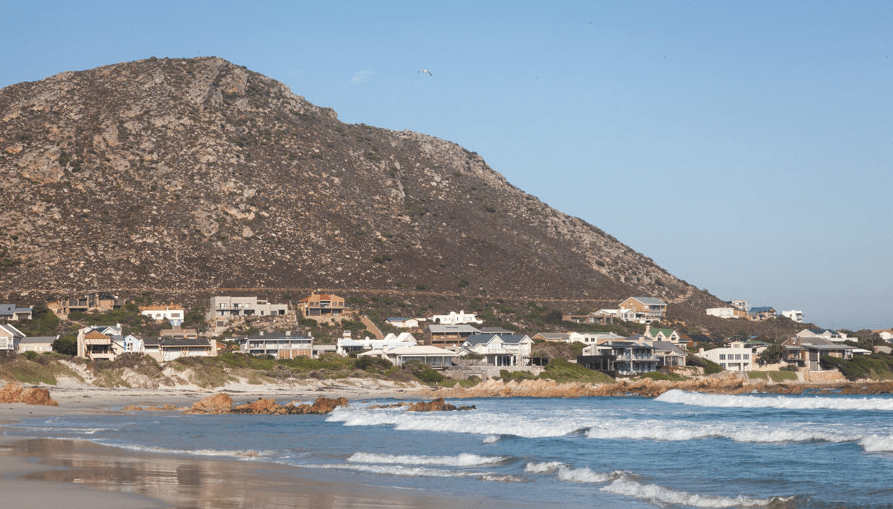
Pringle Bay is a small settlement on the coast below Hangklip (hanging rock) It is within the Koggelberg Biosphere Reserve which is a UNESCO heritage site. The Hangklip mountain is dotted with many natural caves which once gave refuge to bandits and escaped slaves. One of the bigger caves is consequently named “Drostergat” (Deserters cave) These caves have been used by nomadic people for thousands of years. In the early 1920s, excavations unearthed burial sites and some interesting artifacts. These and later digs revealed a lot about the ancient inhabitants of the area.
Many Shipwrecks off the coast
The bay is named after Rear Admiral Thomas Pringle who commanded the Royal Navy in the 1790s. At this time there was a plan to turn the bay into a port from which to ship fresh produce across False Bay to the naval base in Simon’s town. This did not pan out and consequently Pringle Bay remained largely a quiet undeveloped village.
Pringle Bay is however infamous. Ships would turn North too soon at “False Cape” believing they were at Cape Point. There are wrecks of at least 30 ships in the bay.
The village, along with Betty’s Bay and Rooi Els was founded in the 1930s when three businessmen, Harold Porter, Arthur Youldon, and Jack Clarence, bought land and wanted to turn a profit by selling plots and establishing beach estates.
Conservation or forestry
In 1937 responsibility for the area was put under the department of forestry and timber plantations were planned. A local (Harry Molteno son of Prime Minister John Molteno) petitioned that the area should rather be conserved. The idea was supported by the Cape Western Conservancy and The Koggelberg Biosphere Nature Reserve was established.
Development in the area was however delayed due to World War 2. The area was restricted by the military who established a “secret” radar station on the hillside. The Hangklip Hotel was an army barracks and there was also a POW camp where Italian captives were interred, These soldiers were put to work building what is now Clarence Drive. This road improved access to the area and aided development.
There are not many buildings in Pringle Bay, Many are holiday homes. However, though electricity was installed only in 1993 there are no street lights and the night sky is clear.
The license plate prefix is CEM and the postcode for Pringle Bay is 7196 (boxes only)
WEATHER IN PRINGLE BAY TODAY
see all listings in pringle bay
Things to do and see in Pringle Bay
- Koggel Bay Beach is a great surfing area but is a dangerous place to swim while Pringle Bay Beach is safe for swimming and fishing
- Take an easy 30-minute walk on Brodie Link
- Hiking trails near Pringle Bay
- Pringle Bay birding group
Useful Numbers in Pringle Bay
- Police: Kleinmond – 028 271 8200
- Municipality; Kleinmond-028 271 8400
- Traffic department
- Fire:072129 9788
- Water:028 271 8435
- Electricity: Eskom- 086 003 7566
- Ambulance:028 425 1907 (10777)
- Post office; Betty’s bay 028 272 9363
- Library: Bettys bay-028 272 9263
- Closest hospital; Hermanus Prov.-028 312 1166
- Mediclinic Hermanus-028 313 0168
- Pharmacy; Alpha Pharm – Kleinmond-028 271 3320
- NSRI (sea rescue) 021 449 3500
- Mountain rescue 021 937 0300
- SPCA: Kleinmond Animal Welfare Society-028 271 5004
- Wildlife in distress: 072 652 2346
- Schools: Pringle House Eco School-028 273 8853
- Pringle Bay Community Hall: 1772 Buffels Road 079 038 3916
-
Kogelberg Villages Environmental Trustees – KVET A community-run non-profit organization for the ecological interests of the Overstrand villages
- Ratepayers association: 082 491 0771 info@pringlebayratepayers.co.za


