
History of Llandudno
Province; Western Cape
Coordinates; 34.0100° S, 18.3430° E
Area 2.89 km2
Municipality; City Of Cape Town
Llandudno was named after the Welsh seaside resort and it means “Parish of St Tudno”. There are striking similarities between the two seaside bays.
Jan Van Riebeek knew of the path below the twelve apostles which were known then as Gevelbergen (Gable Mountains) The Watermen (a KhoiKhoi clan) used this track for bringing cattle to barter with the Dutch. For centuries this area was inhabited by Strandloopers. This evidenced by artefacts found in caves along the bay and in 1953 a shell midden was found. While the settlers spread the settlement on the East side of the Peninsula, the West side remained untouched. When Victoria road between Camps Bay and Hout Bay was completed in 1887, people could travel to the area. By the time motorised vehicles arrived in the Cape a drive on this road was an essential outing. In 1904 an auction of plots of land was held and the first house was completed in 1905, however, the supply of water was inconsistent. 1947 saw electricity installed and the road was tarred only by 1952. In 1954 a farm school was established which was upgraded in 1957 and became a primary school.
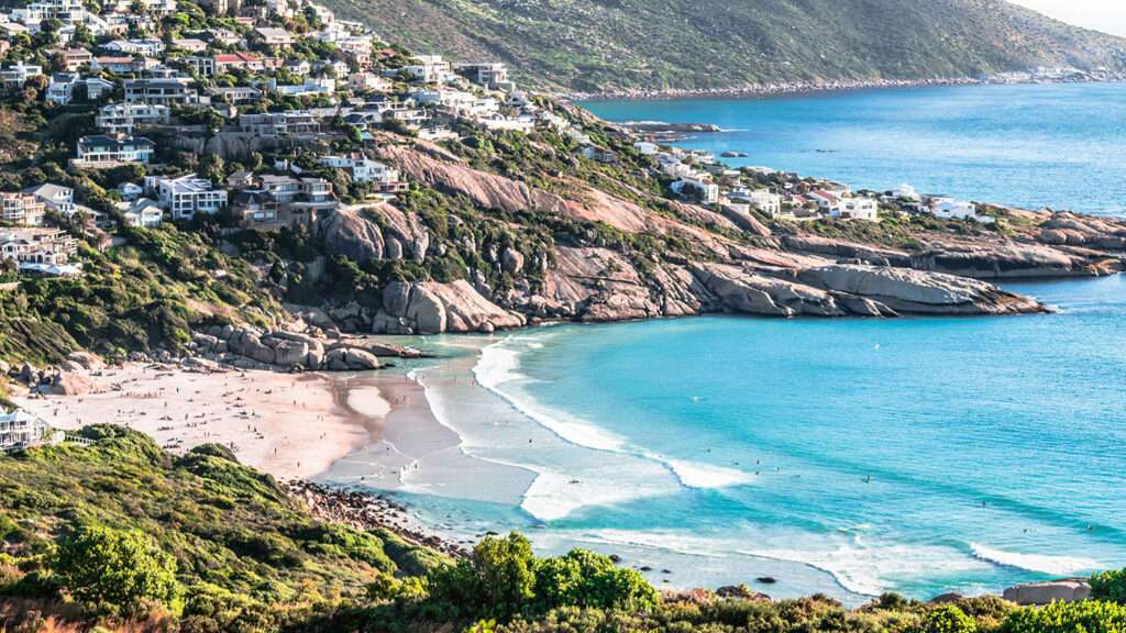
Today the beach at Llandudno remains unspoiled and is surrounded by fynbos. There are still no shops and no street lights in Llandudno.
The postcode for Llandudno is 7806
Things to see and do in Llandudno
- Oudekraal Beach is a very private and intimate beach which is part of Table Mountain National Park, situated between Llandudno and Bakoven. It is a small haven tucked away, surrounded by large boulders which shelter it nicely and also provide a very safe swimming area.
- Scuba divers can explore Justin’s Caves, which are actually a bunch of large boulders smothered in fascinating sea life and stunning soft corals,
- You can visit the wreck of the Huis te Crayenstein which ran aground on the rocks at Oudekraal in 1698. There is a lot here to explore.
- Great Motherstone sacred site
- The pretty stretch of beach called Sandy bay is one of Cape Town’s most inaccessible beaches so consequently is Cape Town’s only recognised unofficial naturist beach It is just around the corner from Llandudno at the base of the Twelve Apostles.
- Logie’s Rocks is a sacred site which, has strong female energy, with the largest boulder looking like a giant breast
WEATHER IN LLANDUDNO TODAY
all listings in llandudno

Useful Numbers
- Police;Hout Bay Police Station-021 791 9300
- Traffic department: Gallows Hill Traffic Department-0860 103 089
- Fire: Hout Bay – 021 480 770
- Water: 0860 103 089
- Electricity: 0860 103 089
- Ambulance: 10177
- Post office; Hout Bay -021 790 1740
- Closest hospital/clinic;Hout Bay Family Medical Centre-021 790 3120
- Library; Hout Bay Public Library-021 791 7660
- SPCA: Cape Of Good Hope Grassy Park 021 700 4140
- Schools; Llandudno Primary school021 790 2010