- Province: Western Cape
- Coordinates: 33°54′S 18°24′E
- Area: 2.01 km2
- Atlantic Seaboard
- Municipality; City of Cape Town
Jump to: History of Green Point |Things to See and Do in Green Point |Useful Numbers in Green Point
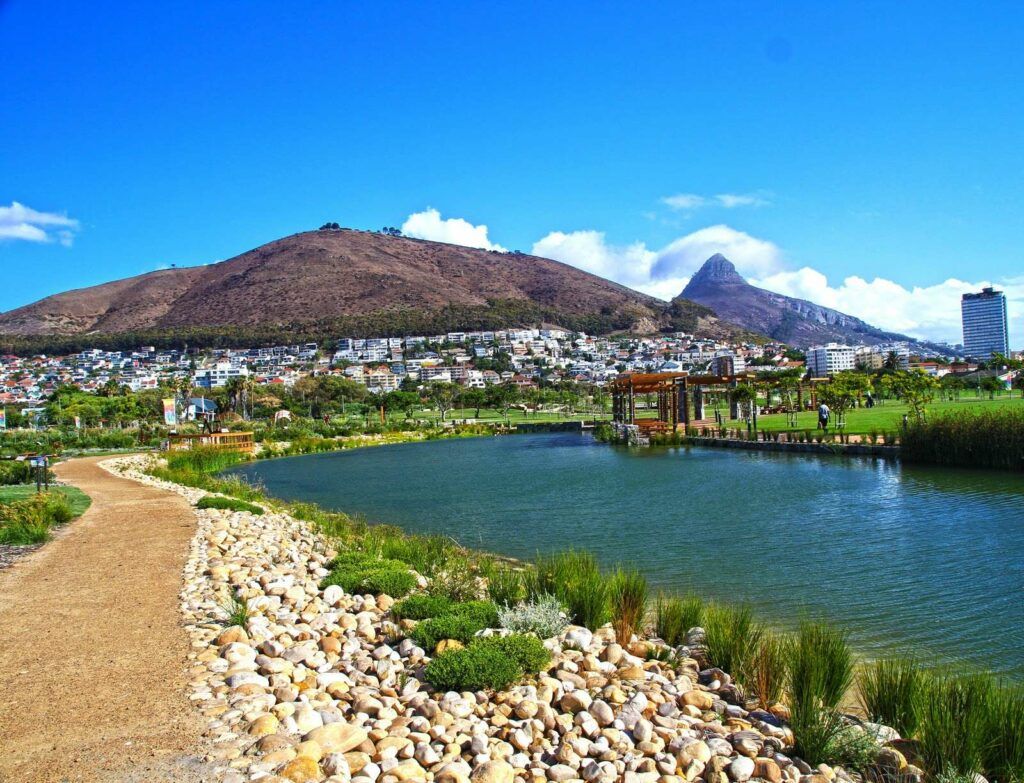
Green Point lies northwest of the Cape Town CBD at the foot of Signal Hill. It is bordered by Sea Point to the west, De Waterkant to the east, and the Foreshore and Waterfront precincts to the southeast.
The suburb is accessed via Somerset Road (M61), Main Road, and Beach Road. The coastline runs along Mouille Point, where a promenade, rocky shore, and small tidal pools connect toward Sea Point.
Cape Town Stadium and the Green Point Urban Park form a large open recreational area along the ocean side of the suburb.
History of Green Point
Green Point was used by the Dutch as a cattle grazing area until the British annexed the Cape in 1806, after which the common was used for horse racing. During the Anglo-Boer war from 1899 to 1902, the Green Point Common was used as a military camp, and Boer prisoners were also interned there. The suburb is now an upmarket area popular with both locals and tourists.
The lighthouse was proposed by Sir Rufane Donkin and designed by Hermann Schutte. It was built in 1824. However, it did not withstand Cape of Storms weather and had to be renovated in 1842. It was dismantled in the 1920s and replaced with a new one. The height of the lighthouse was increased in 1863.
Green Point Lighthouse is the oldest working lighthouse on the South African coast and is a national heritage site.
Today
Green Point is a mixed residential and commercial suburb with apartment blocks, guesthouses, offices, restaurants, and small retail areas. It is one of the closest residential areas to the Cape Town CBD and the Waterfront.
The promenade, park, and stadium attract walkers, runners, and visitors throughout the year. Because of its central location, the suburb is also popular for short-term accommodation and tourism
The postcode for Greenpoint is 8005.(streets) and 8051 (boxes)
Transport
Green Point is served by MyCiTi Bus, Golden Arrow Bus Services, and minibus taxis. See linked pages for details. Other options for getting around the Western Cape.
WEATHER IN GREENPOINT TODAY
Browse businesses and places to visit in Greenpoint
Things to See and Do in Green Point
- The Cape Town stadium on Green Point Common was built for the 2010 FIFA World Cup.
- The Cape Town Festival of Beer in December. Over 250 beers on show from some of the top breweries in South Africa bookings@capetownfestivalofbeer.co.za
- Clock tower playground and jungle gyms in front of the Clock Tower at the V&A Waterfront
- Greenpoint Lighthouse
- Cape Town Carnival
- The Greenpoint Flea Market
- Cape Medical Museum
- Metropolitan Golf Course
- Greenpoint Parkrun Every Saturday at 8:00 am at Green Point Common
- Just off Green Point’s Main Road, at 1 Braemar Road, is a heritage farmstead dating from 1828. This site was inspired by a 1940s book, The Strangers Club, about a place in La Paz where travellers met to share stories and trade goods.
- The white horses on the promenade mark the wreck of the SA Seafarer, which was carrying a cargo of White Horse whisky. Along with the whisky, promotional plastic white horses washed ashore
- Just off Green Point’s Main Road, at 1 Braemar Road, is a heritage farmstead dating from 1828, this site inspired by a 1940s book, The Strangers Club, about a place in La Paz where travellers met to share stories and trade goods.
See also De Waterkant
Resources
Practical information for the Western Cape: regulations, permits, and helpful tips. See the Colourdots coastal and nature use guide

Useful Numbers in Green Point
Residents and visitors can find important local contact numbers below, including police, medical services, utilities, and community facilities in and around
-
Emergency Services
- Police: 021 430 3700
- Fire: Sea Point: 021 434 2020
- Ambulance: 10177
-
Medical
- Closest hospital/clinic: Somerset Hospital -021 402 6911
- Green Point Community Health Centre Pharmacy – 021 421 0288
-
Municipal & Utilities
- Municipality: 0860 103 089
- Water: 0860 103 089
- Electricity: 0860 103 089
-
Transport & Roads
- Traffic department: Gallows Hill 0860 103 089
- Community & Safety
- NSRI 087 094 9774
- SPCA: Cape of Good Hope Grassy Park: 021 700 4140
-
Local Contacts and Community Resources
- Post office; Sea Point – 021 434 2315
- Green Point Ratepayers and Residents Association;076 061 2371
- Museum: Cape Medical Museum – 021 418 5663
-
Schools in Green Point
- Reddam house – 021 433 0105
- Nutwood forest pre-primary – 021 439 4874
- Find a comprehensive list of Cape Town Emergency Numbers HEREBack to the top ↑
Other suburbs along the Atlantic seaboard include: Bantry Bay; Bakoven; Camps Bay; Clifton; Fresnaye; Hout Bay; Llandudno; Mouille Point; Sea Point; and Three Anchor Bay
FAQs – Green Point
1. Where is Green Point located?
It lies between Sea Point and the Cape Town CBD, along the Atlantic Seaboard. It’s close to the V&A Waterfront and Signal Hill.
2. What is Green Point known for?
It’s known for the Cape Town Stadium, the Urban Park, and its mix of restaurants, cafés, and nightlife.
3. How far is Green Point from the city centre?
Only about 2 km — a few minutes by car or an easy walk from the CBD or the Waterfront.
4. What attractions are nearby?
Nearby attractions include Mouille Point Promenade, Green Point Lighthouse, V&A Waterfront, and Sea Point Pavilion.
5. Is Green Point safe?
Yes, it’s generally safe and well-patrolled, especially around the stadium and main roads, though standard city awareness is advised.
6. Are there schools in Green Point?
Yes, including Reddam House Atlantic Seaboard, Holy Cross Convent, and several preschools nearby.
7. Is there public transport?
Yes — MyCiTi buses with direct links to the Waterfront, CBD, and Camps Bay.
8. Is Green Point pet-friendly?
Very, the Urban Park, Promenade, and many cafés welcome dogs on leashes.
9. What type of accommodation is available?
modern apartments, guesthouses, and boutique hotels, many with sea or stadium views.
10. Why visit or live in Green Point?
It’s a vibrant, central suburb close to everything, beaches, restaurants, nightlife, and the city — with a relaxed coastal feel.
- Colourdots is an independent regional information resource for the Western Cape.
Learn more about the project HERE
Updated April 2026